
French Canada from cobblestones to river cliffs
This is leg 2 of 2, the final leg.
 Get the app
Travel leg · Montréal, Québec City & Charlevoix
Québec City and Charlevoix sit about 104 km (65 mi) apart in a straight line, with Charlevoix to the north-east. It is leg 2 of 2 on our Montréal, Québec City & Charlevoix itinerary, an 8-day trip. Here is how long it takes by car, what to see on the way and where it fits in a real itinerary.


Road distance is estimated as 1.2–1.4× the straight line; drive time assumes average speeds of 50–80 km/h with no stops or traffic. These are rough estimates — check a maps app for the actual route.
We don't have live routing data, so the figures below are labelled estimates built from the straight-line distance. Use them to plan the day, then confirm in a maps app.
Most travelers on our Montréal, Québec City & Charlevoix itinerary do this leg by car. We estimate 125–146 km (78–91 mi) of road and 1 h 30 min – 3 h behind the wheel, so check live traffic before you set off.
Our Montréal, Québec City & Charlevoix guide also mentions trains for parts of the trip. Whether a direct train links Québec City and Charlevoix depends on the line — check timetables.
VIA Rail links Montréal and Québec City in about 3.5 hours, and both old towns are walkable. Rent a car in Québec City for Île d'Orléans and Charlevoix, a 90-minute drive along Route 138.
Picks from our curated guides at both ends.
Spend 2–3 nights split between Baie-Saint-Paul and La Malbaie for river views, hikes and farm food.

Artist village with galleries and cafés along Rue Saint-Jean-Baptiste.

Seasonal riverside rail line between Baie-Saint-Paul and La Malbaie, hugging the St. Lawrence shore.

Some of eastern Canada's highest rock walls rise above the river; hike L'Acropole-des-Draveurs or paddle.

Family cheese dairy making Le 1608 and other local cheeses, with a tasting shop.

Clifftop château hotel above the river with a lounge, golf and the Casino de Charlevoix next door.

Ski hill dropping straight toward the St. Lawrence, with summer hiking and the river views year-round.
Give it 2–3 nights for the walled old town plus day trips to the falls and Île d'Orléans.

Landmark hotel above a boardwalk with sweeping views of the St. Lawrence.
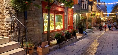
Narrow lower-town lanes of boutiques and bistros under the cliff, reached by funicular or Breakneck Stairs.

Battlefields park where the 1759 battle was fought, now lawns and lookouts over the river.
Where Québec City → Charlevoix sits in the full itinerary. Highlighted stops are this leg.
French Canada from cobblestones to river cliffs
This is leg 2 of 2, the final leg.
Going the other way? Charlevoix to Québec City is the same 104 km in a straight line, heading south-west. Reverse directions in Google Maps ↗
The biggest gap comes in April, when Charlevoix averages highs 3°C cooler than Québec City.
| Measure | Jan | Feb | Mar | Apr | May | Jun | Jul | Aug | Sep | Oct | Nov | Dec |
|---|---|---|---|---|---|---|---|---|---|---|---|---|
| Québec City high | -7° | -5° | -1° | 8° | 17° | 22° | 24° | 23° | 20° | 12° | 4° | -3° |
| Charlevoix high | -9° | -7° | -3° | 5° | 14° | 19° | 22° | 22° | 18° | 10° | 2° | -5° |
| Québec City rain | 66 | 64 | 72 | 93 | 95 | 113 | 123 | 108 | 109 | 119 | 90 | 95 |
| Charlevoix rain | 59 | 62 | 70 | 90 | 93 | 109 | 116 | 106 | 103 | 116 | 87 | 91 |
Temperatures in °C, rain in mm per month. Long-term monthly averages from NASA POWER satellite climatology — a guide to typical conditions, not a forecast. Month headings link to Charlevoix month guides.
Québec City is about 104 km (65 mi) from Charlevoix in a straight line, with Charlevoix to the north-east. By road, we estimate 125–146 km (78–91 mi), or 1.2–1.4 times the straight line. Check a maps app for the exact route.
An estimated 1 h 30 min – 3 h, assuming 125–146 km of road at average speeds of 50–80 km/h with no stops or traffic. It is not a routed time, so check a maps app on the day.
Our Montréal, Québec City & Charlevoix itinerary includes this leg. Montréal, Québec City & Charlevoix runs about 8 days across 3 stops, best in Jun – Oct.
Add this leg to a shared itinerary, poll the group on where to stop, split fuel and tickets, and keep everyone's packing list in one place in TripsCircle.