

Outdoors Charlevoix
Hautes-Gorges-de-la-Rivière-Malbaie National Park
An outdoor spot in Charlevoix, budget-friendly ($) and worth about 5 hours. Best time to go: Fall colour.
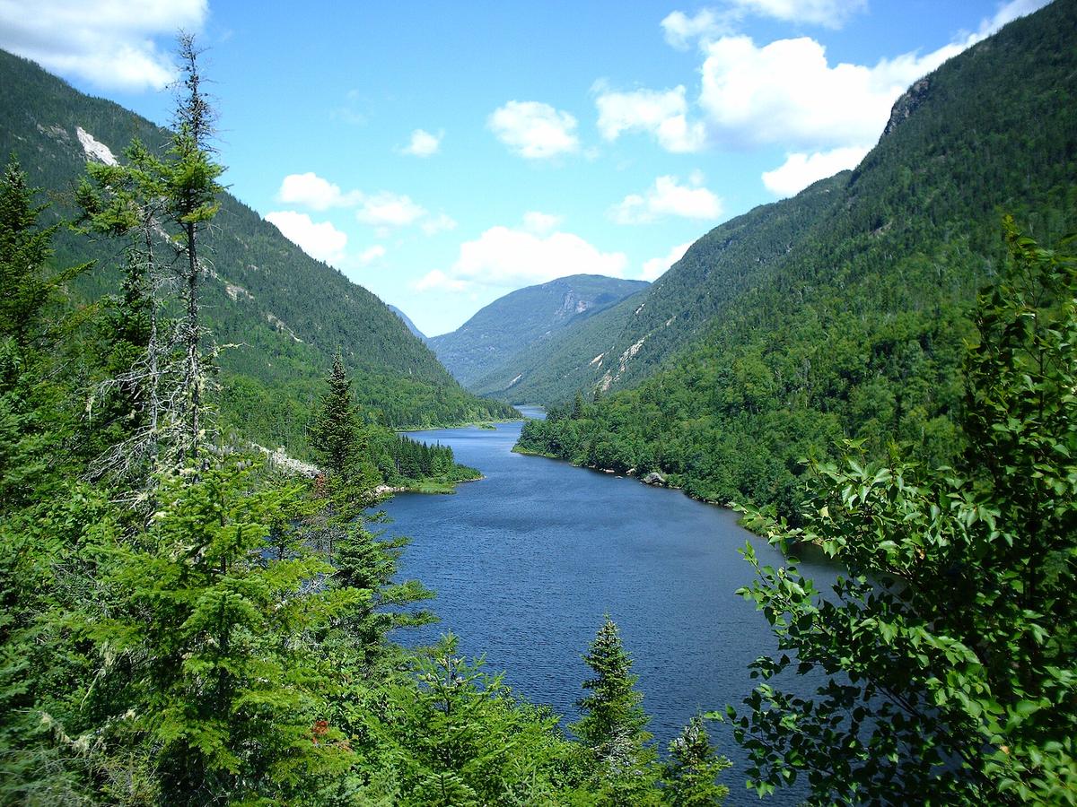
Why go
Some of eastern Canada's highest rock walls rise above the river; hike L'Acropole-des-Draveurs or paddle.
It is one of 9 curated places we feature in Charlevoix, alongside 3 activities, 2 places to eat and 1 place for a drink. The closest of our other picks is Parc national des Grands-Jardins, 26 km away as the crow flies. Set aside about 5 hours here; it works best as the anchor of a day rather than a quick stop.
- Type
- Outdoors · Nature
- Price
- $
- Time needed
- 5 hr
- Best time
- Fall colour
Nearby
The closest curated pick in Charlevoix, measured as straight-line distance.
- 1Parc national des Grands-Jardins
Taiga-like plateau with caribou country and the Mont du Lac des Cygnes summit trail.
Outdoors · 26 km straight-line
On these curated routes
Hautes-Gorges-de-la-Rivière-Malbaie National Park is a stop on our Montréal, Québec City & Charlevoix route. Open it to see the full day-by-day plan.

More to do in Charlevoix
Hautes-Gorges-de-la-Rivière-Malbaie National Park is our only outdoors pick in Charlevoix; here is what else we recommend there. See the full Charlevoix guide.
-

Baie-Saint-Paul
Artist village with galleries and cafés along Rue Saint-Jean-Baptiste.
-
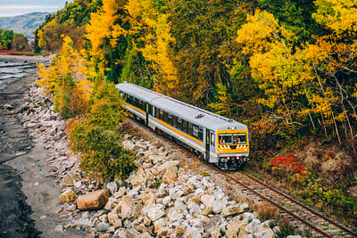
Train de Charlevoix
Seasonal riverside rail line between Baie-Saint-Paul and La Malbaie, hugging the St. Lawrence shore.
-

Le Massif de Charlevoix
Ski hill dropping straight toward the St. Lawrence, with summer hiking and the river views year-round.
-

Isle-aux-Coudres
Short free ferry ride to a flat island loop for cycling past windmills and river views.
-

Laiterie Charlevoix
Family cheese dairy making Le 1608 and other local cheeses, with a tasting shop.
-

Le Saint-Pub
Brewpub of Microbrasserie Charlevoix serving hearty dishes with house Dominus Vobiscum beers.
When to go
Average daily highs in Charlevoix run from -9°C in January to 22°C in July; July is usually the wettest month. For Hautes-Gorges-de-la-Rivière-Malbaie National Park itself, we suggest: Fall colour.
Modelled monthly averages for Charlevoix from NASA POWER, not a forecast. Full Charlevoix weather by month.
Getting there
Map links open a live search for Hautes-Gorges-de-la-Rivière-Malbaie National Park, so hours and directions come straight from the map app.
- Address
- 500 Rue Principale, Saint-Aimé-des-Lacs, QC G0T 1S0, Canada
- Coordinates
- 47.85386, -70.42669
- Destination
- Charlevoix, Quebec
- Website
- sepaq.com
Hautes-Gorges-de-la-Rivière-Malbaie National Park: quick answers
How much time do you need at Hautes-Gorges-de-la-Rivière-Malbaie National Park?
Plan on about 5 hours at Hautes-Gorges-de-la-Rivière-Malbaie National Park. That is our curated estimate for a typical visit; groups that linger will want more.
When is the best time to visit Hautes-Gorges-de-la-Rivière-Malbaie National Park?
Our pick: Fall colour. Insider tip: The Acropole trail is steep; start early.
Where is Hautes-Gorges-de-la-Rivière-Malbaie National Park?
Hautes-Gorges-de-la-Rivière-Malbaie National Park is at 500 Rue Principale, Saint-Aimé-des-Lacs, QC G0T 1S0, Canada. The Google Maps and Apple Maps links on this page open it for directions.
Which TripsCircle routes include Hautes-Gorges-de-la-Rivière-Malbaie National Park?
Hautes-Gorges-de-la-Rivière-Malbaie National Park appears on Montréal, Québec City & Charlevoix, a curated route you can open on TripsCircle and plan with your group.
Add it to your crew's plan
Save it to a shared TripsCircle itinerary, settle the timing with a quick poll, and split the costs with everyone going to Charlevoix.
Plan Charlevoix
- Charlevoix travel guide 9 places
- Best time to visit Charlevoix weather by month
- Québec City to Charlevoix 104 km straight-line
Lists & regions
Also in Charlevoix
- Isle-aux-Coudres Activity
- Laiterie Charlevoix Food
- Fairmont Le Manoir Richelieu Drinks
- Baie-Saint-Paul Sight
Curated recommendation, not live listing data. Confirm hours, prices, bookings and access before you go.