

Activity Charlevoix
Le Massif de Charlevoix
An activity in Charlevoix, pricey ($$$) and worth about 4 hours. Best time to go: Winter.

Why go
Ski hill dropping straight toward the St. Lawrence, with summer hiking and the river views year-round.
It is one of 9 curated places we feature in Charlevoix, alongside 2 activities, 2 places to eat and 2 outdoor spots. The closest of our other picks is Isle-aux-Coudres, 18 km away as the crow flies. Set aside about 4 hours here; it works best as the anchor of a day rather than a quick stop.
- Type
- Activity · Adventure
- Price
- $$$
- Time needed
- 4 hr
- Best time
- Winter
Nearby
The 5 closest curated picks in Charlevoix, measured as straight-line distance.
- 1Isle-aux-Coudres
Short free ferry ride to a flat island loop for cycling past windmills and river views.
Activity · 18 km straight-line - 2Train de Charlevoix
Seasonal riverside rail line between Baie-Saint-Paul and La Malbaie, hugging the St. Lawrence shore.
Activity · 19 km straight-line - 3Le Saint-Pub
Brewpub of Microbrasserie Charlevoix serving hearty dishes with house Dominus Vobiscum beers.
Food · 20 km straight-line - 4Baie-Saint-Paul
Artist village with galleries and cafés along Rue Saint-Jean-Baptiste.
Sight · 20 km straight-line - 5Laiterie Charlevoix
Family cheese dairy making Le 1608 and other local cheeses, with a tasting shop.
Food · 22 km straight-line
On these curated routes
Le Massif de Charlevoix is a stop on our Montréal, Québec City & Charlevoix route. Open it to see the full day-by-day plan.

More to do in Charlevoix
Le Massif de Charlevoix is our only activity pick in Charlevoix; here is what else we recommend there. See the full Charlevoix guide.
-

Hautes-Gorges-de-la-Rivière-Malbaie National Park
Some of eastern Canada's highest rock walls rise above the river; hike L'Acropole-des-Draveurs or paddle.
-
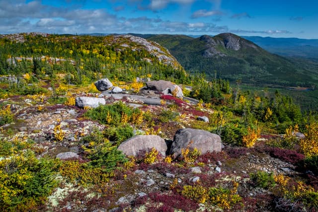
Parc national des Grands-Jardins
Taiga-like plateau with caribou country and the Mont du Lac des Cygnes summit trail.
-
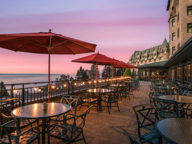
Fairmont Le Manoir Richelieu
Clifftop château hotel above the river with a lounge, golf and the Casino de Charlevoix next door.
When to go
Average daily highs in Charlevoix run from -9°C in January to 22°C in July; July is usually the wettest month. For Le Massif de Charlevoix itself, we suggest: Winter.
Modelled monthly averages for Charlevoix from NASA POWER, not a forecast. Full Charlevoix weather by month.
Getting there
Map links open a live search for Le Massif de Charlevoix, so hours and directions come straight from the map app.
- Address
- 185 Chem. du Massif, Petite-Rivière-Saint-François, QC G0A 2L0, Canada
- Coordinates
- 47.27865, -70.60870
- Destination
- Charlevoix, Quebec
- Website
- lemassif.com
Le Massif de Charlevoix: quick answers
How much time do you need at Le Massif de Charlevoix?
Plan on about 4 hours at Le Massif de Charlevoix. That is our curated estimate for a typical visit; groups that linger will want more.
When is the best time to visit Le Massif de Charlevoix?
Our pick: Winter.
Where is Le Massif de Charlevoix?
Le Massif de Charlevoix is at 185 Chem. du Massif, Petite-Rivière-Saint-François, QC G0A 2L0, Canada. The Google Maps and Apple Maps links on this page open it for directions.
Which TripsCircle routes include Le Massif de Charlevoix?
Le Massif de Charlevoix appears on Montréal, Québec City & Charlevoix, a curated route you can open on TripsCircle and plan with your group.
Add Le Massif de Charlevoix to your crew's plan
Save it to a shared TripsCircle itinerary, settle the timing with a quick poll, and split the costs with everyone going to Charlevoix.
Plan Charlevoix
- Charlevoix travel guide 9 places
- Best time to visit Charlevoix weather by month
- Québec City to Charlevoix 104 km straight-line
Lists & regions
Also in Charlevoix
Curated recommendation, not live listing data. Confirm hours, prices, bookings and access before you go.