


San Francisco to Los Angeles
This is leg 2 of 5.
 Get the app
Travel leg · Pacific Coast Highway
Monterey & Carmel and Big Sur sit about 37 km (23 mi) apart in a straight line, with Big Sur to the south. It is leg 2 of 5 on our Pacific Coast Highway itinerary, a 6-day trip. Here is how long it takes by car, what to see on the way and where it fits in a real itinerary.
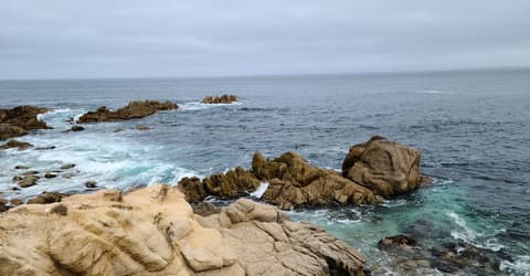
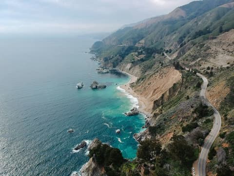
Road distance is estimated as 1.2–1.4× the straight line; drive time assumes average speeds of 50–80 km/h with no stops or traffic. These are rough estimates — check a maps app for the actual route.
We don't have live routing data, so the figures below are labelled estimates built from the straight-line distance. Use them to plan the day, then confirm in a maps app.
Most travelers on our Pacific Coast Highway itinerary do this leg by car. We estimate 45–52 km (28–33 mi) of road and 35 min – 1 h behind the wheel, so check live traffic before you set off.
Our Pacific Coast Highway guide also mentions trains for parts of the trip. Whether a direct train links Monterey and Big Sur depends on the line — check timetables.
A car is the whole point here, and one shared vehicle keeps the group together. Plan to drive south to north or north to south and pick up or drop off a rental in the two big cities. Train and bus options exist for some legs but skip the scenic parts.
Picks from our curated guides at both ends.
Drive it slowly over a full day, stopping at pullouts, one or two short hikes and a cliffside lunch.
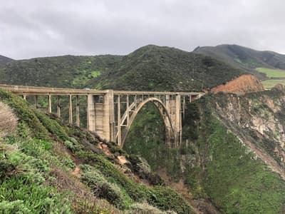
1932 concrete arch bridge, the most photographed spot on Highway 1.

Guided tours of an 1889 lighthouse atop a volcanic rock.

Redwood groves along the Big Sur River with trails to Pfeiffer Falls and Valley View.

Roadside inn where you can sit in chairs set in the river with a drink.

Clifftop restaurant since 1949 with long coastal views from the terrace.

Purple-streaked sand and Keyhole Arch at the end of narrow Sycamore Canyon Road.
Give it a full day: aquarium and Cannery Row in the morning, Point Lobos and Carmel in the afternoon.
Where Monterey → Big Sur sits in the full itinerary. Highlighted stops are this leg.
San Francisco to Los Angeles
This is leg 2 of 5.
Going the other way? Big Sur to Monterey & Carmel is the same 37 km in a straight line, heading north. Reverse directions in Google Maps ↗
Monterey & Carmel is about 37 km (23 mi) from Big Sur in a straight line, with Big Sur to the south. By road, we estimate 45–52 km (28–33 mi), or 1.2–1.4 times the straight line. Check a maps app for the exact route.
An estimated 35 min – 1 h, assuming 45–52 km of road at average speeds of 50–80 km/h with no stops or traffic. It is not a routed time, so check a maps app on the day.
Our Pacific Coast Highway itinerary includes this leg. Pacific Coast Highway runs about 6 days across 6 stops, best in Apr – Oct.
Add this leg to a shared itinerary, poll the group on where to stop, split fuel and tickets, and keep everyone's packing list in one place in TripsCircle.