

Sight Northern Big Sur
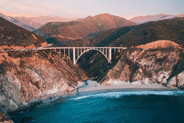
Bixby Creek Bridge
A sight in Northern Big Sur, free to visit and worth about 20 minutes. Best time to go: Late afternoon.

Why go
1932 concrete arch bridge, the most photographed spot on Highway 1.
It is one of 9 curated places we feature in Big Sur, alongside 3 outdoor spots, 2 places to eat and 1 activity. The closest of our other picks is Point Sur Lightstation, 4.3 mi away as the crow flies. At about 20 minutes, it slots neatly between bigger plans.
- Type
- Sight
- Neighborhood
- Northern Big Sur
- Price
- Free
- Time needed
- 20 min
- Best time
- Late afternoon
Nearby
Our closest curated picks, including 3 beyond Big Sur. Distances are straight-line, not walking or driving.
- 1Point Sur Lightstation
Guided tours of an 1889 lighthouse atop a volcanic rock.
Activity · 4.3 mi straight-line - 2Big Sur River Inn
Roadside inn where you can sit in chairs set in the river with a drink.
Drinks · 8.7 mi straight-line - 3Pfeiffer Beach
Purple-streaked sand and Keyhole Arch at the end of narrow Sycamore Canyon Road.
Outdoors · 10 mi straight-line - 4Point Lobos State Natural Reserve
Granite coves, cypress groves and sea otters along easy coastal trails.
Outdoors · Monterey & Carmel · 10 mi straight-line - 5Mission San Carlos Borromeo de Carmelo
Restored 1771 mission with a stone basilica, gardens and museum rooms.
Sight · Monterey & Carmel · 12 mi straight-line - 6Carmel Beach
White-sand beach at the foot of Ocean Avenue with cypress-framed sunsets.
Outdoors · Monterey & Carmel · 12 mi straight-line
On these curated routes
Bixby Creek Bridge is a stop on our Pacific Coast Highway route. Open it to see the full day-by-day plan.
More sights to see in Big Sur
Another curated sight in Big Sur. See the full Big Sur guide.

When to go
Average daily highs in Big Sur run from 58°F in January to 69°F in September; December is usually the wettest month. For Bixby Creek Bridge itself, we suggest: Late afternoon.
Modelled monthly averages for Big Sur from NASA POWER, not a forecast. Full Big Sur weather by month.
Getting there
Map links open a live search for Bixby Creek Bridge, so hours and directions come straight from the map app.
- Address
- Bixby Creek Bridge, California, USA
- Coordinates
- 36.37148, -121.90192
- Destination
- Big Sur, California
Bixby Creek Bridge: quick answers
How much time do you need at Bixby Creek Bridge?
Plan on about 20 minutes at Bixby Creek Bridge. That is our curated estimate for a typical visit; groups that linger will want more.
When is the best time to visit Bixby Creek Bridge?
Our pick: Late afternoon. Insider tip: Use the north-side pullout; check Caltrans for Highway 1 closures before driving.
Is Bixby Creek Bridge free?
Yes, we list Bixby Creek Bridge as free to visit. Check locally before you go, since special exhibits, parking or tours can carry a fee.
Where is Bixby Creek Bridge?
Bixby Creek Bridge is at Bixby Creek Bridge, California, USA, in Northern Big Sur. The Google Maps and Apple Maps links on this page open it for directions.
Which TripsCircle routes include Bixby Creek Bridge?
Bixby Creek Bridge appears on Pacific Coast Highway, a curated route you can open on TripsCircle and plan with your group.
Add Bixby Creek Bridge to your crew's plan
Save it to a shared TripsCircle itinerary, settle the timing with a quick poll, and split the costs with everyone going to Big Sur.
Plan Big Sur
- Big Sur travel guide 9 places
- Best time to visit Big Sur weather by month
- Monterey & Carmel to Big Sur 23 mi straight-line
- Big Sur to San Simeon 54 mi straight-line
Lists & regions
Also in Big Sur
- Deetjen's Big Sur Inn Restaurant Food
- McWay Falls Outdoors
Curated recommendation, not live listing data. Confirm hours, prices, bookings and access before you go.