
Sierra ski days around a deep blue lake
This is leg 2 of 2, the final leg.
 Get the app
Travel leg · South Lake Tahoe, Tahoe City & Truckee
Tahoe City & Palisades and Truckee sit about 21 km (13 mi) apart in a straight line, with Truckee to the north. It is leg 2 of 2 on our South Lake Tahoe, Tahoe City & Truckee itinerary, a 6-day trip. Here is how long it takes by car, what to see on the way and where it fits in a real itinerary.
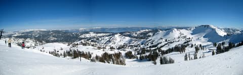
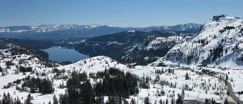
Road distance is estimated as 1.2–1.4× the straight line; drive time assumes average speeds of 25–45 km/h with no stops or traffic. These are rough estimates — check a maps app for the actual route.
We don't have live routing data, so the figures below are labelled estimates built from the straight-line distance. Use them to plan the day, then confirm in a maps app.
Most travelers on our South Lake Tahoe, Tahoe City & Truckee itinerary do this leg by car. We estimate 25–29 km (16–18 mi) of road and 35 min – 1 h 15 min behind the wheel, so check live traffic before you set off.
Fly into Reno-Tahoe (RNO). Reno to South Lake Tahoe is about 1 hour 15 minutes via US-395 and US-50; South Lake Tahoe to Tahoe City is about 1 hour on CA-89 along the west shore; Tahoe City to Truckee is 25 minutes on CA-89; and Truckee back to Reno is 35 minutes on I-80. CA-89 at Emerald Bay closes during and after big storms, so check Caltrans QuickMap and use the Nevada shore (US-50 and NV-28) if it is shut. Rent an all-wheel-drive car with snow tires and carry chains: chain controls are common on I-80 over Donner Summit and US-50 over Echo Summit. Amtrak's California Zephyr stops in Truckee daily from the San Francisco Bay Area.
Picks from our curated guides at both ends.
Old railroad town on I-80; 2 nights for Donner Lake, Northstar and Sugar Bowl.
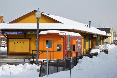
Downtown train depot where Amtrak's California Zephyr stops, with a visitor center and a caboose outside.
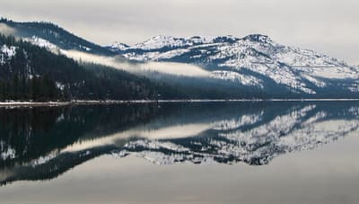
Mountain lake just west of town below Donner Pass, ringed by snowy granite peaks in winter.
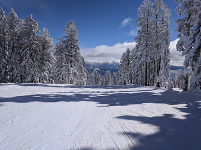
Family-friendly ski resort south of Truckee, with long groomed runs and an outdoor ice rink in its village.
Downtown restaurant and bar in the Truckee Hotel building, with live music most nights.
Victorian-era hotel in downtown Truckee, steps from the depot and Commercial Row.
Park at the east end of Donner Lake with the Pioneer Monument and a museum on the Donner Party and the railroad.
North-shore town by the Truckee River outlet; 2 nights for Palisades Tahoe and the west shore.
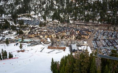
Host of the 1960 Winter Olympics, now linking Olympic Valley and Alpine Meadows by gondola, with steep terrain on KT-22.
West-shore park that hosted the 1960 Olympic cross-country races, with snowshoe and ski trails through pines to the lake.
Bridge in Tahoe City over the Truckee River where it leaves Lake Tahoe, beside the dam that regulates the lake's level.
Where Tahoe City → Truckee sits in the full itinerary. Highlighted stops are this leg.
Sierra ski days around a deep blue lake
This is leg 2 of 2, the final leg.
Going the other way? Truckee to Tahoe City & Palisades is the same 21 km in a straight line, heading south. Reverse directions in Google Maps ↗
Tahoe City & Palisades is about 21 km (13 mi) from Truckee in a straight line, with Truckee to the north. By road, we estimate 25–29 km (16–18 mi), or 1.2–1.4 times the straight line. Check a maps app for the exact route.
An estimated 35 min – 1 h 15 min, assuming 25–29 km of road at average speeds of 25–45 km/h with no stops or traffic. It is not a routed time, so check a maps app on the day.
Our South Lake Tahoe, Tahoe City & Truckee itinerary includes this leg. South Lake Tahoe, Tahoe City & Truckee runs about 6 days across 3 stops, best in Dec – Mar.
Add this leg to a shared itinerary, poll the group on where to stop, split fuel and tickets, and keep everyone's packing list in one place in TripsCircle.