

Outdoors West Shore, Tahoe City & Palisades
Sugar Pine Point State Park
An outdoor spot in West Shore, Tahoe City & Palisades, budget-friendly ($) and worth about 2.5 hours. Best time to go: Midday.
Why go
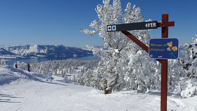
West-shore park that hosted the 1960 Olympic cross-country races, with snowshoe and ski trails through pines to the lake.
It is one of 6 curated places we feature in Tahoe City & Palisades, alongside 1 activity, 1 place for a drink and 1 place to eat. The closest of our other picks is Fire Sign Cafe, 6.0 mi away as the crow flies.
- Type
- Outdoors · Nature
- Neighborhood
- West Shore
- Price
- $
- Time needed
- 2.5 hr
- Best time
- Midday
Nearby
Our closest curated picks, including 1 beyond Tahoe City & Palisades. Distances are straight-line, not walking or driving.
- 1Fire Sign Cafe
West-shore breakfast and lunch cafe in an old cabin south of Tahoe City, serving locals since the 1970s.
Food · 6.0 mi straight-line - 2Granlibakken Tahoe
Wooded resort just outside Tahoe City with its own small ski hill and a sledding hill, popular with families.
Stay · 7.0 mi straight-line - 3Emerald Bay State Park
Granite-walled bay on Lake Tahoe's southwest shore around Fannette Island, the lake's only island.
Outdoors · South Lake Tahoe · 7.3 mi straight-line - 4Bridgetender Tavern & Grill
Long-running Tahoe City tavern next to Fanny Bridge, known for burgers and a patio over the Truckee River.
Drinks · 7.6 mi straight-line - 5Fanny Bridge
Bridge in Tahoe City over the Truckee River where it leaves Lake Tahoe, beside the dam that regulates the lake's level.
Sight · 7.6 mi straight-line - 6Palisades Tahoe
Host of the 1960 Winter Olympics, now linking Olympic Valley and Alpine Meadows by gondola, with steep terrain on KT-22.
Activity · 11 mi straight-line
On these curated routes
Sugar Pine Point State Park is a stop on our South Lake Tahoe, Tahoe City & Truckee route. Open it to see the full day-by-day plan.
When to go
Average daily highs in Tahoe City & Palisades run from 37°F in December to 83°F in July; December is usually the wettest month. For Sugar Pine Point State Park itself, we suggest: Midday.
Modelled monthly averages for Tahoe City & Palisades from NASA POWER, not a forecast. Full Tahoe City & Palisades weather by month.
Getting there
Map links open a live search for Sugar Pine Point State Park, so hours and directions come straight from the map app.
- Coordinates
- 39.05750, -120.12250
- Destination
- Tahoe City & Palisades, California
Sugar Pine Point State Park: quick answers
How much time do you need at Sugar Pine Point State Park?
Plan on about 2.5 hours at Sugar Pine Point State Park. That is our curated estimate for a typical visit; groups that linger will want more.
When is the best time to visit Sugar Pine Point State Park?
Our pick: Midday. Insider tip: Bring snowshoes or skis; after fresh snow the trails along General Creek are quiet and easy to follow.
Which TripsCircle routes include Sugar Pine Point State Park?
Sugar Pine Point State Park appears on South Lake Tahoe, Tahoe City & Truckee, a curated route you can open on TripsCircle and plan with your group.
Add Sugar Pine Point State Park to your crew's plan
Save it to a shared TripsCircle itinerary, settle the timing with a quick poll, and split the costs with everyone going to Tahoe City & Palisades.
Plan Tahoe City & Palisades
- Tahoe City & Palisades travel guide 6 places
- Best time to visit Tahoe City & Palisades weather by month
- Tahoe City & Palisades to Truckee 13 mi straight-line
- South Lake Tahoe to Tahoe City & Palisades 18 mi straight-line
Lists & regions
Curated recommendation, not live listing data. Confirm hours, prices, bookings and access before you go.