


Farolito walks, luminarias and Christmas chile
This is leg 1 of 1, the opening leg.
 Get the app
Travel leg · Santa Fe & Albuquerque
Santa Fe and Albuquerque sit about 93 km (58 mi) apart in a straight line, with Albuquerque to the south-west. It is leg 1 of 1 on our Santa Fe & Albuquerque itinerary, a 5-day trip. Here is how long it takes by car, what to see on the way and where it fits in a real itinerary.
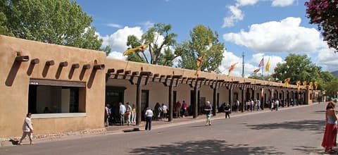

Road distance is estimated as 1.2–1.4× the straight line; drive time assumes average speeds of 50–80 km/h with no stops or traffic. These are rough estimates — check a maps app for the actual route.
We don't have live routing data, so the figures below are labelled estimates built from the straight-line distance. Use them to plan the day, then confirm in a maps app.
Most travelers on our Santa Fe & Albuquerque itinerary do this leg by car. We estimate 112–130 km (69–81 mi) of road and 1 h 30 min – 2 h 30 min behind the wheel, so check live traffic before you set off.
Our Santa Fe & Albuquerque guide also mentions trains for parts of the trip. Whether a direct train links Santa Fe and Albuquerque depends on the line — check timetables.
Fly into Albuquerque International Sunport (ABQ) and rent a car; Santa Fe is about an hour north on I-25, or take the New Mexico Rail Runner train. Downtown Santa Fe, the Plaza and Canyon Road are walkable, while Ski Santa Fe and Ten Thousand Waves are up Hyde Park Road. In Albuquerque, Old Town, the BioPark and the museums sit close together; the tram base is 25 minutes northeast.
Picks from our curated guides at both ends.
Rio Grande city with luminaria-lined Old Town; 2 nights for River of Lights and the Sandia tram.
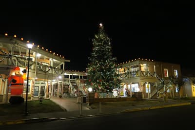
The original 1706 plaza, with adobe shops and a lit Christmas tree, lined with luminarias on Christmas Eve.
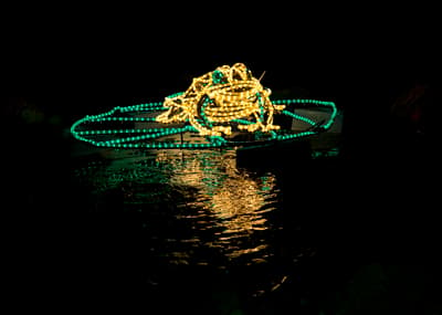
Walk-through light show at the ABQ BioPark Botanic Garden, with large lit sculptures of animals and plants.
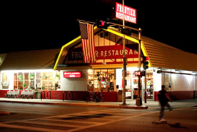
Busy diner across from the university since 1971, known for breakfast burritos and sweet rolls.
Historic inn and lavender farm in the North Valley, with a farm-to-table restaurant, Campo.
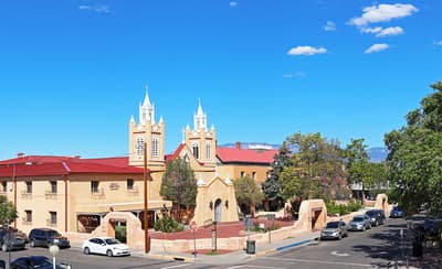
Adobe church from 1793 on the north side of the Old Town plaza, still an active parish.
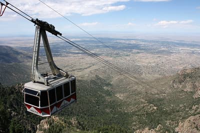
Aerial tram climbing about 4 km to the 3,163 m crest of the Sandias, often snowy in winter, with views over the city.
High-desert capital lined with farolitos; 3 nights for Canyon Road, the Plaza and the mountains.
Where Santa Fe → Albuquerque sits in the full itinerary. Highlighted stops are this leg.
Farolito walks, luminarias and Christmas chile
This is leg 1 of 1, the opening leg.
Going the other way? Albuquerque to Santa Fe is the same 93 km in a straight line, heading north-east. Reverse directions in Google Maps ↗
The biggest gap comes in February, when Albuquerque averages highs 5°C warmer than Santa Fe.
| Measure | Jan | Feb | Mar | Apr | May | Jun | Jul | Aug | Sep | Oct | Nov | Dec |
|---|---|---|---|---|---|---|---|---|---|---|---|---|
| Santa Fe high | 5° | 7° | 13° | 18° | 24° | 31° | 31° | 29° | 25° | 18° | 11° | 5° |
| Albuquerque high | 9° | 13° | 18° | 23° | 29° | 35° | 35° | 33° | 29° | 23° | 15° | 9° |
| Santa Fe rain | 19 | 17 | 18 | 19 | 20 | 19 | 62 | 50 | 41 | 30 | 19 | 24 |
| Albuquerque rain | 14 | 12 | 11 | 14 | 13 | 12 | 51 | 43 | 34 | 22 | 15 | 17 |
Temperatures in °C, rain in mm per month. Long-term monthly averages from NASA POWER satellite climatology — a guide to typical conditions, not a forecast. Month headings link to Albuquerque month guides.
Santa Fe is about 93 km (58 mi) from Albuquerque in a straight line, with Albuquerque to the south-west. By road, we estimate 112–130 km (69–81 mi), or 1.2–1.4 times the straight line. Check a maps app for the exact route.
An estimated 1 h 30 min – 2 h 30 min, assuming 112–130 km of road at average speeds of 50–80 km/h with no stops or traffic. It is not a routed time, so check a maps app on the day.
Our Santa Fe & Albuquerque itinerary includes this leg. Santa Fe & Albuquerque runs about 5 days across 2 stops, best in Mid-Dec – early Jan.
Add this leg to a shared itinerary, poll the group on where to stop, split fuel and tickets, and keep everyone's packing list in one place in TripsCircle.