


Harbour city, sandstone cliffs and coral
This is leg 2 of 3.
 Get the app
Travel leg · Sydney, Blue Mountains & the Reef
Blue Mountains and Cairns sit about 1,922 km (1,194 mi) apart in a straight line, with Cairns to the north. It is leg 2 of 3 on our Sydney, Blue Mountains & the Reef itinerary, an 11-day trip. At this distance a flight may be the typical way to cover it.

Road distance is estimated as 1.2–1.4× the straight line; drive time assumes average speeds of 65–95 km/h with no stops or traffic. These are rough estimates — check a maps app for the actual route.
We don't have live routing data, so the figures below are labelled estimates built from the straight-line distance. Use them to plan the day, then confirm in a maps app.
At 1,922 km in a straight line, a flight may be the most typical way to cover this leg, though our route guide also mentions trains. Driving would be an estimated 2,306–2,690 km and 24 h 15 min – 41 h 30 min at the wheel, usually split over more than one day.
Sydney's trains and ferries cover the city, and Sydney Trains run direct to Katoomba. Fly Sydney to Cairns (about 3 hours), then rent a car or use shuttles for the 70-minute coastal drive to Port Douglas.
Picks from our curated guides at both ends.
Tropical gateway to the Great Barrier Reef and the Wet Tropics rainforest. Stay 3 days.

Coral cay 45 minutes from Cairns with rainforest, snorkeling and glass-bottom boats.

Fast catamaran to a pontoon on Moore Reef for snorkeling, diving and a semi-submarine.

Weekend produce market with tropical fruit, local coffee and food stalls.

Marina restaurant whose menu uses more than 30 Australian native ingredients.

Marina-side bar and restaurant with DJs and open-air decks.

Heritage train climbing the Barron Gorge to the rainforest village of Kuranda.
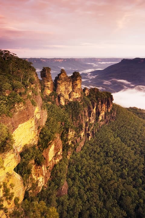
Sandstone cliffs and eucalyptus valleys around Katoomba, two hours from Sydney. Stay 2 days.
Where Blue Mountains → Cairns sits in the full itinerary. Highlighted stops are this leg.
Harbour city, sandstone cliffs and coral
This is leg 2 of 3.
Going the other way? Cairns to Blue Mountains is the same 1,922 km in a straight line, heading south. Reverse directions in Google Maps ↗
The biggest gap comes in July, when Cairns averages highs 15°C warmer than Blue Mountains. Over a year, Cairns gets about 1,190 mm more rain.
| Measure | Jan | Feb | Mar | Apr | May | Jun | Jul | Aug | Sep | Oct | Nov | Dec |
|---|---|---|---|---|---|---|---|---|---|---|---|---|
| Blue Mountains high | 27° | 25° | 21° | 18° | 13° | 10° | 9° | 11° | 15° | 19° | 22° | 25° |
| Cairns high | 31° | 30° | 29° | 28° | 26° | 25° | 25° | 26° | 28° | 30° | 31° | 32° |
| Blue Mountains rain | 81 | 110 | 85 | 47 | 33 | 60 | 36 | 41 | 41 | 56 | 81 | 78 |
| Cairns rain | 352 | 392 | 392 | 191 | 103 | 63 | 53 | 31 | 31 | 62 | 86 | 179 |
Temperatures in °C, rain in mm per month. Long-term monthly averages from NASA POWER satellite climatology — a guide to typical conditions, not a forecast. Month headings link to Cairns month guides.
Blue Mountains is about 1,922 km (1,194 mi) from Cairns in a straight line, with Cairns to the north. By road, we estimate 2,306–2,690 km (1,433–1,672 mi), or 1.2–1.4 times the straight line. Check a maps app for the exact route.
An estimated 24 h 15 min – 41 h 30 min, assuming 2,306–2,690 km of road at average speeds of 65–95 km/h with no stops or traffic. It is not a routed time, so check a maps app on the day. At this distance, a flight may be more practical.
Our Sydney, Blue Mountains & the Reef itinerary includes this leg. Sydney, Blue Mountains & the Reef runs about 11 days across 4 stops, best in May – Oct.
Add this leg to a shared itinerary, poll the group on where to stop, split fuel and tickets, and keep everyone's packing list in one place in TripsCircle.