
Neon lights meet red canyons
This is leg 2 of 2, the final leg.
 Get the app
Travel leg · Las Vegas & National Parks
Zion NP and Bryce Canyon sit about 81 km (50 mi) apart in a straight line, with Bryce Canyon to the north-east. It is leg 2 of 2 on our Las Vegas & National Parks itinerary, a 5-day trip. Here is how long it takes by car, what to see on the way and where it fits in a real itinerary.
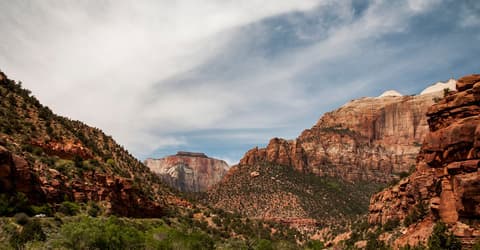

Road distance is estimated as 1.2–1.4× the straight line; drive time assumes average speeds of 50–80 km/h with no stops or traffic. These are rough estimates — check a maps app for the actual route.
We don't have live routing data, so the figures below are labelled estimates built from the straight-line distance. Use them to plan the day, then confirm in a maps app.
Most travelers on our Las Vegas & National Parks itinerary do this leg by car. We estimate 97–113 km (60–70 mi) of road and 1 h 15 min – 2 h 15 min behind the wheel, so check live traffic before you set off.
Fly into Las Vegas, rent a car and drive north into Utah. Distances between the parks are manageable for a short trip. Zion has a shuttle system for its main canyon during busy periods, so check current park information before you go.
Picks from our curated guides at both ends.
One full day with a sunrise and a hoodoo loop covers the highlights; stay overnight for the dark-sky programs.

Rim overlook facing east over the Bryce Amphitheater's densest hoodoos.

3-mile combo descending through Wall Street's slot to Queen Victoria hoodoo.

8-mile loop through quieter hoodoos and Tower Bridge, fewer crowds than the main trails.

1920s rim lodge dining room, the only sit-down restaurant inside the park.
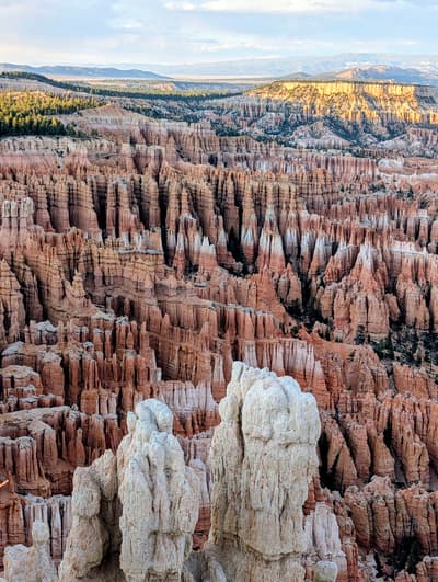
Three-level viewpoint looking straight into the Silent City hoodoo maze.
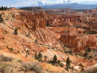
Southern end of the amphitheater with the widest panorama of the hoodoos.
Give Zion two full days: one for the shuttle-served main canyon hikes, one for the Narrows or east side.

Main canyon road served by the free park shuttle, stopping at every major trailhead.

Short trails to pools and seasonal waterfalls below Red Arch Mountain.

Rents dry suits, neoprene socks and walking sticks for the Narrows, next to the park entrance.
Where Zion NP → Bryce Canyon sits in the full itinerary. Highlighted stops are this leg.
Neon lights meet red canyons
This is leg 2 of 2, the final leg.
Going the other way? Bryce Canyon to Zion NP is the same 81 km in a straight line, heading south-west. Reverse directions in Google Maps ↗
The biggest gap comes in January, when Bryce Canyon averages highs 5°C cooler than Zion.
| Measure | Jan | Feb | Mar | Apr | May | Jun | Jul | Aug | Sep | Oct | Nov | Dec |
|---|---|---|---|---|---|---|---|---|---|---|---|---|
| Zion high | 6° | 7° | 12° | 16° | 22° | 30° | 32° | 30° | 26° | 18° | 11° | 5° |
| Bryce Canyon high | 1° | 3° | 8° | 13° | 19° | 26° | 28° | 26° | 22° | 14° | 7° | 0° |
| Zion rain | 32 | 36 | 32 | 26 | 18 | 7 | 34 | 32 | 25 | 32 | 23 | 35 |
| Bryce Canyon rain | 23 | 24 | 20 | 15 | 14 | 8 | 31 | 33 | 26 | 31 | 17 | 21 |
Zion averages cover Zion NP, 0 km away. Temperatures in °C, rain in mm per month. Long-term monthly averages from NASA POWER satellite climatology — a guide to typical conditions, not a forecast. Month headings link to Bryce Canyon month guides.
Zion NP is about 81 km (50 mi) from Bryce Canyon in a straight line, with Bryce Canyon to the north-east. By road, we estimate 97–113 km (60–70 mi), or 1.2–1.4 times the straight line. Check a maps app for the exact route.
An estimated 1 h 15 min – 2 h 15 min, assuming 97–113 km of road at average speeds of 50–80 km/h with no stops or traffic. It is not a routed time, so check a maps app on the day.
Our Las Vegas & National Parks itinerary includes this leg. Las Vegas & National Parks runs about 5 days across 3 stops, best in Mar – May.
Add this leg to a shared itinerary, poll the group on where to stop, split fuel and tickets, and keep everyone's packing list in one place in TripsCircle.