
Colonial wreaths, tavern suppers, garden lights
This is leg 1 of 1, the opening leg.
 Get the app
Travel leg · Williamsburg & Richmond
Williamsburg and Richmond sit about 71 km (44 mi) apart in a straight line, with Richmond to the north-west. It is leg 1 of 1 on our Williamsburg & Richmond itinerary, a 4-day trip. Here is how long it takes by car, what to see on the way and where it fits in a real itinerary.


Road distance is estimated as 1.2–1.4× the straight line; drive time assumes average speeds of 50–80 km/h with no stops or traffic. These are rough estimates — check a maps app for the actual route.
We don't have live routing data, so the figures below are labelled estimates built from the straight-line distance. Use them to plan the day, then confirm in a maps app.
Most travelers on our Williamsburg & Richmond itinerary do this leg by car. We estimate 85–100 km (53–62 mi) of road and 1 h – 2 h behind the wheel, so check live traffic before you set off.
Fly into Richmond (RIC) or Newport News/Williamsburg (PHF), or take Amtrak's Northeast Regional to Williamsburg or Richmond Main Street Station. Williamsburg to Richmond is about an hour on I-64. The Historic Area is walkable, with Colonial Williamsburg shuttle buses around its edge; drive or ride-share to Busch Gardens and to Lewis Ginter, 15 minutes north of downtown Richmond.
Picks from our curated guides at both ends.
Virginia's capital for garden lights and a grand hotel tree; 1-2 nights.
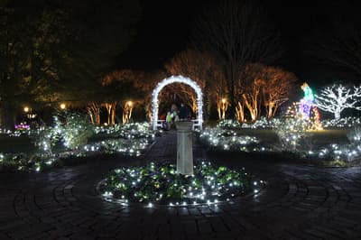
Lewis Ginter Botanical Garden's winter light show, with lit gardens, model trains and a glowing conservatory.
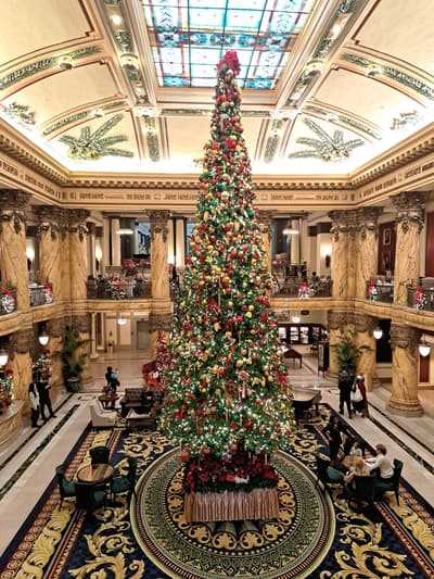
1895 Beaux-Arts hotel whose marble staircase and stained-glass lobby hold a towering Christmas tree each December.

Capitol designed by Thomas Jefferson after a Roman temple, with free guided tours.

Gilded Age estate on the James River with gardens, wildlife habitats and the Dooley Mansion, decorated for the holidays.
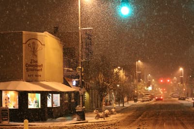
Nine blocks of independent shops, cafes and the 1928 Byrd Theatre along West Cary Street.
Jackson Ward soul food restaurant known for fried chicken, catfish and candied yams.
Colonial capital dressed in natural wreaths; 2 nights for the Historic Area and Christmas Town.
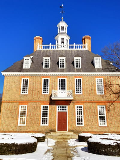
Reconstructed residence of Virginia's royal governors at the head of the Palace Green, with formal gardens and a maze.
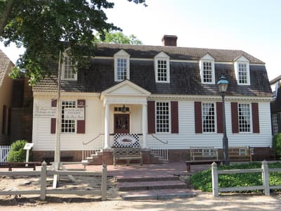
Colonial Williamsburg tavern serving game pie, peanut soup and other 18th-century Virginia dishes by candlelight.

Colonial Revival shopping street at the edge of the Historic Area, with shops, cafes and The Cheese Shop.
Where Williamsburg → Richmond sits in the full itinerary. Highlighted stops are this leg.
Colonial wreaths, tavern suppers, garden lights
This is leg 1 of 1, the opening leg.
Going the other way? Richmond to Williamsburg is the same 71 km in a straight line, heading south-east. Reverse directions in Google Maps ↗
Average daytime highs at both ends stay within 1°C of each other all year, so you can pack the same way for both.
| Measure | Jan | Feb | Mar | Apr | May | Jun | Jul | Aug | Sep | Oct | Nov | Dec |
|---|---|---|---|---|---|---|---|---|---|---|---|---|
| Williamsburg high | 7° | 9° | 14° | 20° | 25° | 30° | 32° | 31° | 27° | 21° | 15° | 10° |
| Richmond high | 7° | 9° | 14° | 20° | 25° | 30° | 33° | 32° | 28° | 21° | 15° | 9° |
| Williamsburg rain | 72 | 69 | 86 | 89 | 104 | 118 | 122 | 136 | 121 | 106 | 83 | 93 |
| Richmond rain | 73 | 70 | 88 | 90 | 111 | 113 | 112 | 125 | 116 | 100 | 89 | 95 |
Temperatures in °C, rain in mm per month. Long-term monthly averages from NASA POWER satellite climatology — a guide to typical conditions, not a forecast. Month headings link to Richmond month guides.
Williamsburg is about 71 km (44 mi) from Richmond in a straight line, with Richmond to the north-west. By road, we estimate 85–100 km (53–62 mi), or 1.2–1.4 times the straight line. Check a maps app for the exact route.
An estimated 1 h – 2 h, assuming 85–100 km of road at average speeds of 50–80 km/h with no stops or traffic. It is not a routed time, so check a maps app on the day.
Our Williamsburg & Richmond itinerary includes this leg. Williamsburg & Richmond runs about 4 days across 2 stops, best in Late Nov – Dec.
Add this leg to a shared itinerary, poll the group on where to stop, split fuel and tickets, and keep everyone's packing list in one place in TripsCircle.