
Fishing villages, polar night, northern lights
This is leg 2 of 2, the final leg.
 Get the app
Travel leg · Lofoten & Tromsø
Svolvær and Tromsø sit about 236 km (146 mi) apart in a straight line, with Tromsø to the north-east. It is leg 2 of 2 on our Lofoten & Tromsø itinerary, an 8-day trip. Here is how long it takes by car, what to see on the way and where it fits in a real itinerary.

Road distance is estimated as 1.2–1.4× the straight line; drive time assumes average speeds of 65–95 km/h with no stops or traffic. These are rough estimates — check a maps app for the actual route.
We don't have live routing data, so the figures below are labelled estimates built from the straight-line distance. Use them to plan the day, then confirm in a maps app.
Most travelers on our Lofoten & Tromsø itinerary do this leg by car. We estimate 283–330 km (176–205 mi) of road and 3 h – 5 h behind the wheel, so check live traffic before you set off.
Fly Oslo to Bodø and on to Leknes with Widerøe, or take the car ferry from Bodø to Moskenes (about 3 to 3.5 hours). Hire a car with studded tyres; Reine to Svolvær is about 130 km on the E10, 2 hours in good conditions. From Svolvær the northbound Hurtigruten sails in the evening and reaches Tromsø the next afternoon, or fly via Bodø. In Tromsø the airport bus and city buses reach everything; tours pick up in the centre.
Picks from our curated guides at both ends.
Arctic city for the polar night, aurora trips and sled dogs; 3 nights.

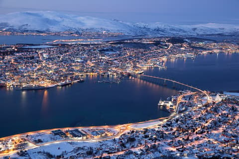
Tromsdalen's 1965 triangular church, lit from within at night, with a huge glass mosaic on its east wall.

Cable car up to Storsteinen, 421 m above sea level, for the view over the island city and the bridge.

Tromsø's oldest pub, opened in 1928 at the Mack brewery, pouring dozens of taps beside a stuffed polar bear.
Harbourside seafood restaurant serving Arctic cod, king crab and seasonal skrei.
Harbour hotel shaped like a ship's bridge, with rooms looking across to the Arctic Cathedral.

Arctic aquarium in a building shaped like toppled ice floes, with bearded seals and polar-region exhibits.
Lofoten's main town and base for Henningsvær and Kabelvåg; 2 nights.

Restored fishermen's cabins on the island of Svinøya, linked to central Svolvær by a short bridge.

Private collection in a 1923 post-office building covering the German occupation of Lofoten and the 1941 commando raids.
Restaurant in an 1828 fish-trading house on Svinøya, serving stockfish, cod and lamb by candlelight.
Where Svolvær → Tromsø sits in the full itinerary. Highlighted stops are this leg.
Fishing villages, polar night, northern lights
This is leg 2 of 2, the final leg.
Going the other way? Tromsø to Svolvær is the same 236 km in a straight line, heading south-west. Reverse directions in Google Maps ↗
The biggest gap comes in January, when Tromsø averages highs 6°C cooler than Svolvær.
| Measure | Jan | Feb | Mar | Apr | May | Jun | Jul | Aug | Sep | Oct | Nov | Dec |
|---|---|---|---|---|---|---|---|---|---|---|---|---|
| Svolvær high | 2° | 1° | 2° | 5° | 8° | 11° | 15° | 14° | 12° | 8° | 5° | 3° |
| Tromsø high | -4° | -4° | -1° | 3° | 9° | 13° | 17° | 16° | 11° | 4° | 0° | -2° |
| Svolvær rain | 122 | 106 | 108 | 83 | 71 | 83 | 92 | 93 | 139 | 135 | 137 | 145 |
| Tromsø rain | 106 | 109 | 120 | 89 | 95 | 106 | 112 | 113 | 137 | 122 | 114 | 124 |
Temperatures in °C, rain in mm per month. Long-term monthly averages from NASA POWER satellite climatology — a guide to typical conditions, not a forecast. Month headings link to Tromsø month guides.
Svolvær is about 236 km (146 mi) from Tromsø in a straight line, with Tromsø to the north-east. By road, we estimate 283–330 km (176–205 mi), or 1.2–1.4 times the straight line. Check a maps app for the exact route.
An estimated 3 h – 5 h, assuming 283–330 km of road at average speeds of 65–95 km/h with no stops or traffic. It is not a routed time, so check a maps app on the day.
Our Lofoten & Tromsø itinerary includes this leg. Lofoten & Tromsø runs about 8 days across 3 stops, best in Late Nov – Mar.
Add this leg to a shared itinerary, poll the group on where to stop, split fuel and tickets, and keep everyone's packing list in one place in TripsCircle.