
A Bavarian village of lights over the Cascades
This is leg 2 of 2, the final leg.
 Get the app
Travel leg · Seattle, Snoqualmie Pass & Leavenworth
Snoqualmie Pass and Leavenworth sit about 59 km (37 mi) apart in a straight line, with Leavenworth to the east. It is leg 2 of 2 on our Seattle, Snoqualmie Pass & Leavenworth itinerary, a 5-day trip. Here is how long it takes by car, what to see on the way and where it fits in a real itinerary.

Road distance is estimated as 1.2–1.4× the straight line; drive time assumes average speeds of 50–80 km/h with no stops or traffic. These are rough estimates — check a maps app for the actual route.
We don't have live routing data, so the figures below are labelled estimates built from the straight-line distance. Use them to plan the day, then confirm in a maps app.
Most travelers on our Seattle, Snoqualmie Pass & Leavenworth itinerary do this leg by car. We estimate 71–83 km (44–52 mi) of road and 55 min – 1 h 45 min behind the wheel, so check live traffic before you set off.
Seattle to Snoqualmie Falls is about 40 minutes on I-90; the pass is another 30 minutes. From the pass to Leavenworth via I-90, WA 970 and US 97 over Blewett Pass is about 1.5 hours, and Leavenworth back to Seattle over Stevens Pass on US 2 is about 2.5 hours. Fly into Seattle-Tacoma (SEA). Winter passes often require traction tires or chains, so check WSDOT pass reports before leaving. Amtrak's Empire Builder also stops at Leavenworth's Icicle Station.
Open Snoqualmie Pass → Leavenworth directions in Google Maps ↗
Picks from our curated guides at both ends.
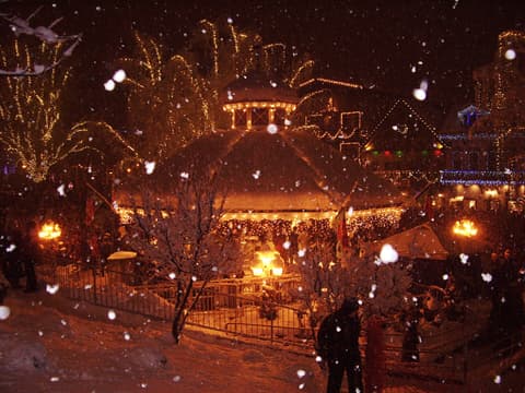
Two nights in the Bavarian-style village for the lights and the snow.

Upstairs museum on Front Street with thousands of nutcrackers from around the world, some centuries old.

Year-round Christmas store on Front Street selling ornaments, nutcrackers and German smokers.
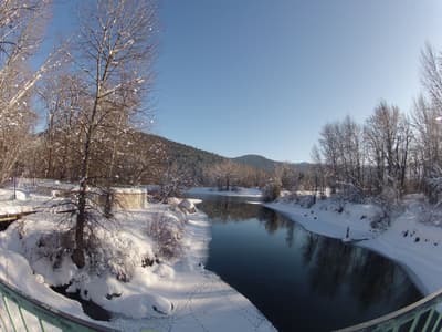
Riverside trails in Waterfront Park, a short walk from Front Street, along the Wenatchee River.

Major ski area on the Cascade crest, 45 minutes west of Leavenworth on US 2, with night skiing on the front side.
Open-air Bavarian grill on Front Street serving bratwurst and German beer year-round, with heaters and fire pits in winter.
Retreat on Icicle Creek two miles from town, with cabins in the pines, a rock-pool hot tub and Chihuly glass on the grounds.
A day on I-90: the falls, a depot full of trains, then snow at the pass.

A 268-foot waterfall on the Snoqualmie River, running at full force in the wet winter months.

Lodge on the rim of Snoqualmie Falls with fireplaces in the rooms, a spa and a long-running country breakfast.

Railway museum based in the 1890 Snoqualmie Depot, running its Santa Train to the falls on December weekends.
Where Snoqualmie Pass → Leavenworth sits in the full itinerary. Highlighted stops are this leg.
A Bavarian village of lights over the Cascades
This is leg 2 of 2, the final leg.
Going the other way? Leavenworth to Snoqualmie Pass is the same 59 km in a straight line, heading west. Reverse directions in Google Maps ↗
The biggest gap comes in July, when Leavenworth averages highs 9°C warmer than Snoqualmie Pass. Over a year, Snoqualmie Pass gets about 950 mm more rain.
| Measure | Jan | Feb | Mar | Apr | May | Jun | Jul | Aug | Sep | Oct | Nov | Dec |
|---|---|---|---|---|---|---|---|---|---|---|---|---|
| Snoqualmie Pass high | 1° | 1° | 3° | 6° | 13° | 16° | 20° | 21° | 17° | 10° | 4° | 0° |
| Leavenworth high | 3° | 5° | 9° | 13° | 20° | 24° | 29° | 29° | 23° | 15° | 8° | 3° |
| Snoqualmie Pass rain | 258 | 167 | 197 | 130 | 101 | 78 | 29 | 38 | 76 | 183 | 258 | 249 |
| Leavenworth rain | 121 | 77 | 88 | 55 | 50 | 34 | 13 | 17 | 32 | 81 | 117 | 125 |
Temperatures in °C, rain in mm per month. Long-term monthly averages from NASA POWER satellite climatology — a guide to typical conditions, not a forecast. Month headings link to Leavenworth month guides.
Snoqualmie Pass is about 59 km (37 mi) from Leavenworth in a straight line, with Leavenworth to the east. By road, we estimate 71–83 km (44–52 mi), or 1.2–1.4 times the straight line. Check a maps app for the exact route.
An estimated 55 min – 1 h 45 min, assuming 71–83 km of road at average speeds of 50–80 km/h with no stops or traffic. It is not a routed time, so check a maps app on the day.
Our Seattle, Snoqualmie Pass & Leavenworth itinerary includes this leg. Seattle, Snoqualmie Pass & Leavenworth runs about 5 days across 3 stops, best in Late Nov – Dec.
Add this leg to a shared itinerary, poll the group on where to stop, split fuel and tickets, and keep everyone's packing list in one place in TripsCircle.