
Bogotá, Salento, Medellín and Cartagena
This is leg 2 of 3.
 Get the app
Travel leg · Colombia: Coffee to Caribbean
Salento and Medellín sit about 179 km (111 mi) apart in a straight line, with Medellín to the north. It is leg 2 of 3 on our Colombia: Coffee to Caribbean itinerary, a 12-day trip. Here is how long it takes by bus, what to see on the way and where it fits in a real itinerary.


Road distance is estimated as 1.2–1.4× the straight line; drive time assumes average speeds of 65–95 km/h with no stops or traffic. These are rough estimates — check a maps app for the actual route.
We don't have live routing data, so the figures below are labelled estimates built from the straight-line distance. Use them to plan the day, then confirm in a maps app.
Our Colombia: Coffee to Caribbean guide points to buses for getting around, and a car works too: an estimated 214–250 km of road and 2 h 15 min – 3 h 45 min of driving.
Domestic flights on Avianca, LATAM and others link Bogotá, Armenia/Pereira, Medellín and Cartagena cheaply. In the Coffee Region, local buses and Willys jeeps run between Salento, Cocora and Filandia.
Picks from our curated guides at both ends.
Valley city with year-round spring weather, cable cars and a busy food scene. Stay 3 days.

Hillside neighborhood transformed by outdoor escalators, murals and hip-hop, best seen with a local guide.

Forest reserve above the city reached by Metrocable Line L, with trails and a farmers' market.

Climb 700-plus steps up a granite monolith over a reservoir, then walk Guatapé's painted streets.
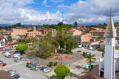
Chef-run restaurant in El Poblado pairing Colombian ingredients with modern technique.

Specialty coffee bar sourcing from Antioquian farms, with pour-overs and cold brew.
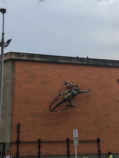
23 bronze Botero sculptures in the plaza and a museum with his paintings.
Colorful village in the Coffee Region, base for Cocora's wax palms and farm tours. Stay 3 days.

Cloud-forest valley of towering Quindío wax palms, Colombia's national tree, with a loop trail.

Main street of painted balconies and craft shops ending in steps up to a valley lookout.

Working coffee farm near Salento offering tours from plant to cup with a tasting.
Where Salento → Medellín sits in the full itinerary. Highlighted stops are this leg.
Bogotá, Salento, Medellín and Cartagena
This is leg 2 of 3.
Going the other way? Medellín to Salento is the same 179 km in a straight line, heading south. Reverse directions in Google Maps ↗
The biggest gap comes in July, when Medellín averages highs 3°C warmer than Salento. Over a year, Medellín gets about 640 mm more rain.
| Measure | Jan | Feb | Mar | Apr | May | Jun | Jul | Aug | Sep | Oct | Nov | Dec |
|---|---|---|---|---|---|---|---|---|---|---|---|---|
| Salento high | 21° | 21° | 21° | 21° | 21° | 21° | 21° | 21° | 21° | 21° | 20° | 21° |
| Medellín high | 24° | 24° | 24° | 24° | 24° | 24° | 24° | 24° | 24° | 23° | 23° | 23° |
| Salento rain | 87 | 104 | 145 | 193 | 168 | 113 | 90 | 91 | 110 | 194 | 191 | 146 |
| Medellín rain | 134 | 111 | 155 | 230 | 246 | 179 | 183 | 206 | 202 | 232 | 221 | 172 |
Temperatures in °C, rain in mm per month. Long-term monthly averages from NASA POWER satellite climatology — a guide to typical conditions, not a forecast. Month headings link to Medellín month guides.
Salento is about 179 km (111 mi) from Medellín in a straight line, with Medellín to the north. By road, we estimate 214–250 km (133–155 mi), or 1.2–1.4 times the straight line. Check a maps app for the exact route.
An estimated 2 h 15 min – 3 h 45 min, assuming 214–250 km of road at average speeds of 65–95 km/h with no stops or traffic. It is not a routed time, so check a maps app on the day.
Our Colombia: Coffee to Caribbean itinerary includes this leg. Colombia: Coffee to Caribbean runs about 12 days across 4 stops, best in Dec – Mar.
Add this leg to a shared itinerary, poll the group on where to stop, split fuel and tickets, and keep everyone's packing list in one place in TripsCircle.