
Three midnight drops on Duval, then the Keys
This is leg 1 of 1, the opening leg.
 Get the app
Travel leg · Key West New Year's Eve
Old Town & Duval Street and Bahia Honda & the Lower Keys sit about 56 km (35 mi) apart in a straight line, with Bahia Honda & the Lower Keys to the east. It is leg 1 of 1 on our Key West New Year's Eve itinerary, a 3-day trip. Here is how long it takes by car, what to see on the way and where it fits in a real itinerary.
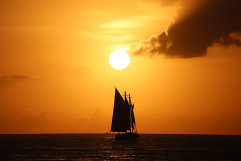
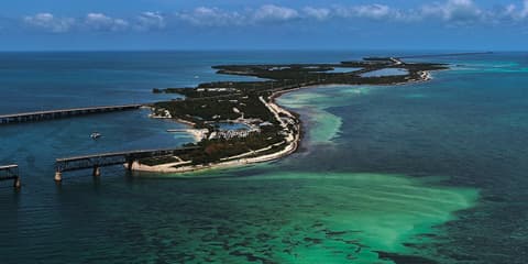
Road distance is estimated as 1.2–1.4× the straight line; drive time assumes average speeds of 50–80 km/h with no stops or traffic. These are rough estimates — check a maps app for the actual route.
We don't have live routing data, so the figures below are labelled estimates built from the straight-line distance. Use them to plan the day, then confirm in a maps app.
Most travelers on our Key West New Year's Eve itinerary do this leg by car. We estimate 67–79 km (42–49 mi) of road and 50 min – 1 h 30 min behind the wheel, so check live traffic before you set off.
Fly into Key West International (EYW), about 10 minutes from Old Town, or drive about 3.5 hours from Miami on the Overseas Highway. Walk or bike in Old Town; the three drops are within a 15-minute walk of each other. Parking near Duval is scarce on Dec 31. On Jan 1, Bahia Honda is about 50 minutes by car; traffic on the highway is heavy in the afternoon.
Picks from our curated guides at both ends.
A slow Jan 1 drive up the Overseas Highway to a beach, old railroad bridges and Key deer.

A wide sandy beach on clear, shallow water, about 40 miles up the Overseas Highway from Key West.

A section of Flagler's 1912 railroad bridge inside the park, with a walkway on top that looks over the channel.
A pizza and beer stop on a back road of Big Pine Key, its walls covered in signed dollar bills.
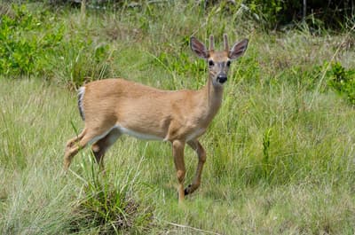
A freshwater pond in an old quarry in the National Key Deer Refuge, where small Key deer and alligators are often seen.
A shallow coral reef in the Florida Keys National Marine Sanctuary, reached by snorkel boats from Big Pine and Ramrod Key.

A 2.2-mile walk or bike ride on the restored old bridge from Marathon out to Pigeon Key.
Two nights in Old Town for sunset at Mallory Square, Cuban food and three midnight drops along Duval.

A giant lit conch shell lowered from the roof of Sloppy Joe's at midnight, watched by a crowd that fills Duval Street.
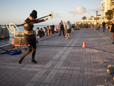
The nightly sunset celebration on the Gulf side, with street performers, food carts and boats crossing the horizon.
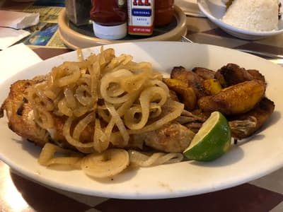
A family-run Cuban restaurant on a residential corner, known for roast pork, plantains and Cuban bread.
Where Old Town → Bahia Honda sits in the full itinerary. Highlighted stops are this leg.
Three midnight drops on Duval, then the Keys
This is leg 1 of 1, the opening leg.
Going the other way? Bahia Honda & the Lower Keys to Old Town & Duval Street is the same 56 km in a straight line, heading west. Reverse directions in Google Maps ↗
Average daytime highs at both ends stay within 1°C of each other all year, so you can pack the same way for both.
| Measure | Jan | Feb | Mar | Apr | May | Jun | Jul | Aug | Sep | Oct | Nov | Dec |
|---|---|---|---|---|---|---|---|---|---|---|---|---|
| Key West high | 23° | 23° | 24° | 26° | 27° | 29° | 30° | 30° | 29° | 28° | 26° | 24° |
| Bahia Honda high | 23° | 24° | 24° | 26° | 27° | 29° | 30° | 30° | 29° | 28° | 26° | 24° |
| Key West rain | 33 | 34 | 26 | 44 | 96 | 157 | 127 | 156 | 177 | 116 | 49 | 39 |
| Bahia Honda rain | 26 | 33 | 25 | 47 | 102 | 153 | 129 | 153 | 167 | 109 | 50 | 34 |
Key West averages cover Old Town & Duval Street, 2.6 km away. Temperatures in °C, rain in mm per month. Long-term monthly averages from NASA POWER satellite climatology — a guide to typical conditions, not a forecast. Month headings link to Bahia Honda & the Lower Keys month guides.
Old Town & Duval Street is about 56 km (35 mi) from Bahia Honda & the Lower Keys in a straight line, with Bahia Honda & the Lower Keys to the east. By road, we estimate 67–79 km (42–49 mi), or 1.2–1.4 times the straight line. Check a maps app for the exact route.
An estimated 50 min – 1 h 30 min, assuming 67–79 km of road at average speeds of 50–80 km/h with no stops or traffic. It is not a routed time, so check a maps app on the day.
Our Key West New Year's Eve itinerary includes this leg. Key West New Year's Eve runs about 3 days across 2 stops, best in Dec 30 – Jan 1.
Add this leg to a shared itinerary, poll the group on where to stop, split fuel and tickets, and keep everyone's packing list in one place in TripsCircle.