
Wild horses, dunes & barrier-island villages
This is leg 2 of 2, the final leg.
 Get the app
Travel leg · Outer Banks Beach Road
Nags Head and Ocracoke sit about 99 km (62 mi) apart in a straight line, with Ocracoke to the south. It is leg 2 of 2 on our Outer Banks Beach Road itinerary, a 6-day trip. This one most likely involves a water crossing, so check ferry schedules early.
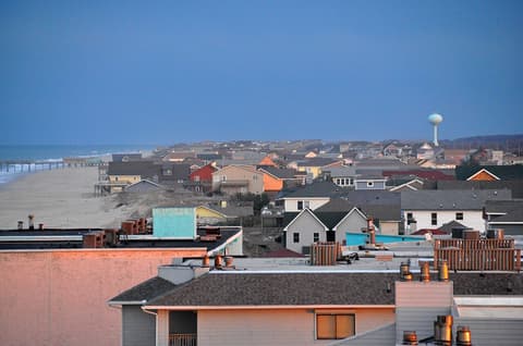
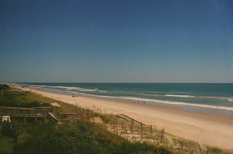
This leg most likely crosses water, so we don’t estimate road distance or drive time. Check ferry or flight schedules for the actual crossing.
We don't have live routing data, so the figures below are labelled estimates built from the straight-line distance. Use them to plan the day, then confirm in a maps app.
Ocracoke most likely needs a water crossing from here, so start with ferry schedules. Sailings can vary by season.
You drive along the main road down the islands, then take a ferry to reach Ocracoke. Corolla's wild horse area has special rules and often needs four-wheel drive or a guided tour. Check ferry schedules and road conditions ahead of time.
Picks from our curated guides at both ends.
Stay a night or two in the village: bike everything, swim the empty beach and eat by the harbor.

1823 whitewashed lighthouse, the oldest operating in North Carolina.

Maritime forest trail to a sound beach linked to Blackbeard's hangout.

Dockside raw bar on Silver Lake for shrimp, oysters and fish tacos.

Island brewery with a deck near the harbor, named for Blackbeard's last year.

Village harbor ringed by docks, shops and seafood spots; best explored by bike.

Wide, undeveloped beach in Cape Hatteras National Seashore.
Base here two days: dunes at sunset, Wright Brothers and Roanoke Island history, and seafood on the beach road.

Tallest living sand dune system on the East Coast; prime for sunset and kite flying.
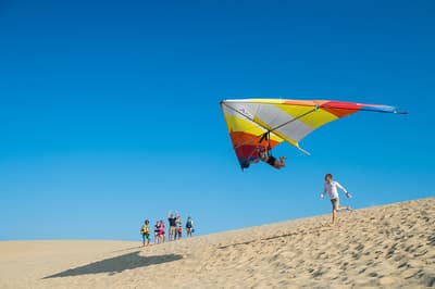
Beginner hang gliding lessons on the dunes of Jockey's Ridge.

Site of the first powered flights, with markers and a granite monument on Kill Devil Hill.
Where Nags Head → Ocracoke sits in the full itinerary. Highlighted stops are this leg.
Wild horses, dunes & barrier-island villages
This is leg 2 of 2, the final leg.
Going the other way? Ocracoke to Nags Head is the same 99 km in a straight line, heading north. Reverse directions in Google Maps ↗
The biggest gap comes in March, when Ocracoke averages highs 4°C warmer than Nags Head. Over a year, Ocracoke gets about 150 mm more rain.
| Measure | Jan | Feb | Mar | Apr | May | Jun | Jul | Aug | Sep | Oct | Nov | Dec |
|---|---|---|---|---|---|---|---|---|---|---|---|---|
| Nags Head high | 10° | 11° | 12° | 17° | 21° | 26° | 28° | 28° | 25° | 21° | 16° | 13° |
| Ocracoke high | 13° | 14° | 16° | 20° | 23° | 27° | 29° | 28° | 26° | 23° | 18° | 15° |
| Nags Head rain | 85 | 89 | 93 | 89 | 102 | 114 | 142 | 158 | 156 | 99 | 92 | 101 |
| Ocracoke rain | 85 | 97 | 95 | 98 | 113 | 128 | 157 | 195 | 186 | 113 | 98 | 107 |
Temperatures in °C, rain in mm per month. Long-term monthly averages from NASA POWER satellite climatology — a guide to typical conditions, not a forecast. Month headings link to Ocracoke month guides.
Nags Head is about 99 km (62 mi) from Ocracoke in a straight line, with Ocracoke to the south. The trip most likely involves a water crossing, so the distance you actually travel depends on the ferry or flight route.
We don't estimate a drive time for this one: it most likely crosses water, so check ferry schedules before you plan the day.
Our Outer Banks Beach Road itinerary includes this leg. Outer Banks Beach Road runs about 6 days across 3 stops, best in May – Oct.
Add this leg to a shared itinerary, poll the group on where to stop, split fuel and tickets, and keep everyone's packing list in one place in TripsCircle.