

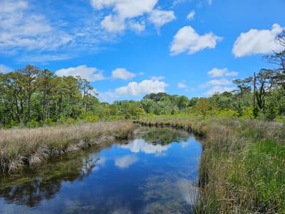
Wild horses, dunes & barrier-island villages
This is leg 1 of 2, the opening leg.
 Get the app
Travel leg · Outer Banks Beach Road
Corolla and Nags Head sit about 51 km (31 mi) apart in a straight line, with Nags Head to the south. It is leg 1 of 2 on our Outer Banks Beach Road itinerary, a 6-day trip. Here is how long it takes by car, what to see on the way and where it fits in a real itinerary.

Road distance is estimated as 1.2–1.4× the straight line; drive time assumes average speeds of 50–80 km/h with no stops or traffic. These are rough estimates — check a maps app for the actual route.
We don't have live routing data, so the figures below are labelled estimates built from the straight-line distance. Use them to plan the day, then confirm in a maps app.
Most travelers on our Outer Banks Beach Road itinerary do this leg by car. We estimate 61–71 km (38–44 mi) of road and 45 min – 1 h 30 min behind the wheel, so check live traffic before you set off.
You drive along the main road down the islands, then take a ferry to reach Ocracoke. Corolla's wild horse area has special rules and often needs four-wheel drive or a guided tour. Check ferry schedules and road conditions ahead of time.
Picks from our curated guides at both ends.
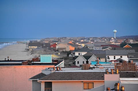
Base here two days: dunes at sunset, Wright Brothers and Roanoke Island history, and seafood on the beach road.

Tallest living sand dune system on the East Coast; prime for sunset and kite flying.
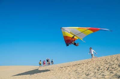
Beginner hang gliding lessons on the dunes of Jockey's Ridge.

Site of the first powered flights, with markers and a granite monument on Kill Devil Hill.

Fishing-shack restaurant since 1937 serving seafood and breakfast.

Wind-powered brewpub with house beers and live music.

Concrete ocean pier with fishing, exhibits and views over the surf.
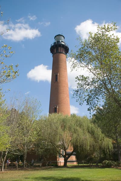
Give it a day for a wild-horse tour, the lighthouse climb and Duck for food and coffee.
Where Corolla → Nags Head sits in the full itinerary. Highlighted stops are this leg.
Wild horses, dunes & barrier-island villages
This is leg 1 of 2, the opening leg.
Going the other way? Nags Head to Corolla is the same 51 km in a straight line, heading north. Reverse directions in Google Maps ↗
The biggest gap comes in March, when Nags Head averages highs 2°C warmer than Corolla.
| Measure | Jan | Feb | Mar | Apr | May | Jun | Jul | Aug | Sep | Oct | Nov | Dec |
|---|---|---|---|---|---|---|---|---|---|---|---|---|
| Corolla high | 9° | 9° | 11° | 15° | 20° | 25° | 27° | 27° | 25° | 21° | 16° | 12° |
| Nags Head high | 10° | 11° | 12° | 17° | 21° | 26° | 28° | 28° | 25° | 21° | 16° | 13° |
| Corolla rain | 85 | 87 | 92 | 86 | 97 | 104 | 133 | 149 | 146 | 102 | 89 | 100 |
| Nags Head rain | 85 | 89 | 93 | 89 | 102 | 114 | 142 | 158 | 156 | 99 | 92 | 101 |
Temperatures in °C, rain in mm per month. Long-term monthly averages from NASA POWER satellite climatology — a guide to typical conditions, not a forecast. Month headings link to Nags Head month guides.
Corolla is about 51 km (31 mi) from Nags Head in a straight line, with Nags Head to the south. By road, we estimate 61–71 km (38–44 mi), or 1.2–1.4 times the straight line. Check a maps app for the exact route.
An estimated 45 min – 1 h 30 min, assuming 61–71 km of road at average speeds of 50–80 km/h with no stops or traffic. It is not a routed time, so check a maps app on the day.
Our Outer Banks Beach Road itinerary includes this leg. Outer Banks Beach Road runs about 6 days across 3 stops, best in May – Oct.
Add this leg to a shared itinerary, poll the group on where to stop, split fuel and tickets, and keep everyone's packing list in one place in TripsCircle.