
Kochi, Munnar tea estates and houseboat canals
This is leg 2 of 2, the final leg.
 Get the app
Travel leg · Kerala Backwaters & Tea Hills
Munnar and Alleppey & Kumarakom sit about 103 km (64 mi) apart in a straight line, with Alleppey & Kumarakom to the south-west. It is leg 2 of 2 on our Kerala Backwaters & Tea Hills itinerary, an 8-day trip. Here is how long it takes by car, what to see on the way and where it fits in a real itinerary.

Road distance is estimated as 1.2–1.4× the straight line; drive time assumes average speeds of 50–80 km/h with no stops or traffic. These are rough estimates — check a maps app for the actual route.
We don't have live routing data, so the figures below are labelled estimates built from the straight-line distance. Use them to plan the day, then confirm in a maps app.
Most travelers on our Kerala Backwaters & Tea Hills itinerary do this leg by car. We estimate 123–144 km (77–89 mi) of road and 1 h 30 min – 3 h behind the wheel, so check live traffic before you set off.
Fly into Cochin International Airport. A hired car with driver is the easiest way to link Kochi, Munnar (about 4 hours) and Alleppey (about 4–5 hours from Munnar). Local ferries and auto-rickshaws handle short hops.
Picks from our curated guides at both ends.
Canals, paddy fields and houseboats on Vembanad Lake. Stay 2–3 nights.

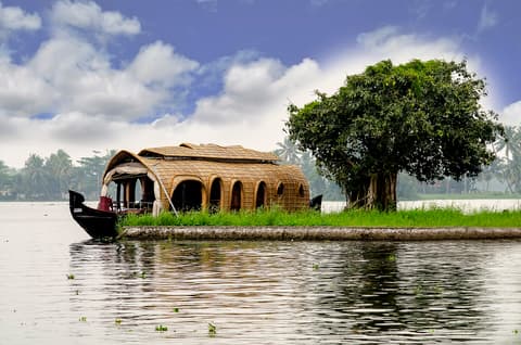
Overnight trip on a converted rice barge through canals, villages and paddy fields.

Uninhabited island in Vembanad Lake with a walking path through mangroves and palms, home to herons, cormorants and egrets.

Busy Hindu temple in Alleppey's market area, center of the December Chirap festival.

Popular local spot for Kerala parotta, beef fry and Malabar biryani.

Kerala's palm-wine bars, serving fresh toddy with fiery fish and tapioca dishes.

Guided kayak trips through narrow canals that houseboats cannot reach.
Hill station surrounded by tea estates and Western Ghats peaks. Stay 2 nights.

Grassland park that protects the endangered Nilgiri tahr, below Anamudi, South India's highest peak.

Museum and working factory showing how Munnar tea is picked, rolled and dried.

One of the world's highest tea estates, reached by jeep for sunrise above the clouds.
Where Munnar → Alleppey sits in the full itinerary. Highlighted stops are this leg.
Kochi, Munnar tea estates and houseboat canals
This is leg 2 of 2, the final leg.
Going the other way? Alleppey & Kumarakom to Munnar is the same 103 km in a straight line, heading north-east. Reverse directions in Google Maps ↗
The biggest gap comes in December, when Alleppey & Kumarakom averages highs 9°C warmer than Munnar. Over a year, Alleppey & Kumarakom gets about 670 mm more rain.
| Measure | Jan | Feb | Mar | Apr | May | Jun | Jul | Aug | Sep | Oct | Nov | Dec |
|---|---|---|---|---|---|---|---|---|---|---|---|---|
| Munnar high | 22° | 26° | 27° | 26° | 23° | 20° | 19° | 20° | 20° | 21° | 21° | 21° |
| Alleppey high | 30° | 31° | 31° | 31° | 30° | 29° | 28° | 28° | 28° | 28° | 29° | 30° |
| Munnar rain | 12 | 22 | 48 | 106 | 221 | 330 | 297 | 250 | 228 | 318 | 169 | 39 |
| Alleppey rain | 16 | 33 | 67 | 146 | 302 | 475 | 410 | 336 | 302 | 377 | 199 | 47 |
Temperatures in °C, rain in mm per month. Long-term monthly averages from NASA POWER satellite climatology — a guide to typical conditions, not a forecast. Month headings link to Alleppey & Kumarakom month guides.
Munnar is about 103 km (64 mi) from Alleppey & Kumarakom in a straight line, with Alleppey & Kumarakom to the south-west. By road, we estimate 123–144 km (77–89 mi), or 1.2–1.4 times the straight line. Check a maps app for the exact route.
An estimated 1 h 30 min – 3 h, assuming 123–144 km of road at average speeds of 50–80 km/h with no stops or traffic. It is not a routed time, so check a maps app on the day.
Our Kerala Backwaters & Tea Hills itinerary includes this leg. Kerala Backwaters & Tea Hills runs about 8 days across 3 stops, best in Oct – Mar.
Add this leg to a shared itinerary, poll the group on where to stop, split fuel and tickets, and keep everyone's packing list in one place in TripsCircle.