
Skyline, architecture & lakeshore
This is leg 2 of 2, the final leg.
 Get the app
Travel leg · Chicago & Great Lakes
Milwaukee and Door County sit about 225 km (140 mi) apart in a straight line, with Door County to the north. It is leg 2 of 2 on our Chicago & Great Lakes itinerary, a 6-day trip. Here is how long it takes by car, what to see on the way and where it fits in a real itinerary.
Road distance is estimated as 1.2–1.4× the straight line; drive time assumes average speeds of 65–95 km/h with no stops or traffic. These are rough estimates — check a maps app for the actual route.
We don't have live routing data, so the figures below are labelled estimates built from the straight-line distance. Use them to plan the day, then confirm in a maps app.
Most travelers on our Chicago & Great Lakes itinerary do this leg by car. We estimate 270–315 km (168–196 mi) of road and 2 h 45 min – 4 h 45 min behind the wheel, so check live traffic before you set off.
Most travelers drive. Chicago works fine without a car, so many groups pick one up when leaving for Milwaukee. From there the road continues north up the Wisconsin shore to Door County, where having your own car matters for reaching parks and villages.
Picks from our curated guides at both ends.
Give the peninsula two to three days for parks, lighthouses, cherry stands and a fish boil.

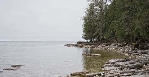
Lake Michigan waves crash into undercut limestone ledges.
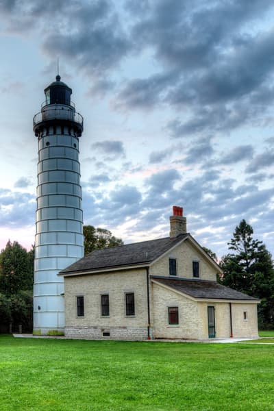
1869 lighthouse on an island reached by wading or a hay wagon across the causeway.

Ferry across Death's Door strait to a quiet island with beaches and lavender farms.

Traditional Door County fish boil with the flame-up finale, followed by cherry pie.

Winery in an old schoolhouse pouring cherry and fruit wines.
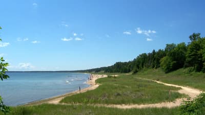
Sand dunes and a long beach next to Cave Point.
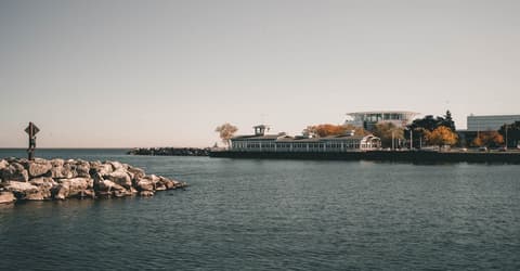
One day covers the lakefront museum, the Third Ward and a brewery; stay the night for custard and cocktails.

Calatrava's lakefront pavilion with moving 'wings' and a strong collection.

Third Ward market hall with seafood, cheese, Wisconsin specialties and an upstairs seating area.

Riverside path linking the Third Ward and downtown, passing the Bronze Fonz.
Where Milwaukee → Door County sits in the full itinerary. Highlighted stops are this leg.
Skyline, architecture & lakeshore
This is leg 2 of 2, the final leg.
Going the other way? Door County to Milwaukee is the same 225 km in a straight line, heading south. Reverse directions in Google Maps ↗
The biggest gap comes in May, when Door County averages highs 5°C cooler than Milwaukee.
| Measure | Jan | Feb | Mar | Apr | May | Jun | Jul | Aug | Sep | Oct | Nov | Dec |
|---|---|---|---|---|---|---|---|---|---|---|---|---|
| Milwaukee high | -2° | -1° | 6° | 13° | 19° | 25° | 28° | 27° | 23° | 15° | 8° | 1° |
| Door County high | -3° | -3° | 3° | 8° | 14° | 20° | 24° | 24° | 20° | 13° | 6° | 0° |
| Milwaukee rain | 40 | 43 | 59 | 96 | 109 | 125 | 95 | 100 | 90 | 82 | 55 | 54 |
| Door County rain | 36 | 36 | 52 | 80 | 93 | 100 | 85 | 83 | 86 | 93 | 57 | 54 |
Temperatures in °C, rain in mm per month. Long-term monthly averages from NASA POWER satellite climatology — a guide to typical conditions, not a forecast. Month headings link to Door County month guides.
Milwaukee is about 225 km (140 mi) from Door County in a straight line, with Door County to the north. By road, we estimate 270–315 km (168–196 mi), or 1.2–1.4 times the straight line. Check a maps app for the exact route.
An estimated 2 h 45 min – 4 h 45 min, assuming 270–315 km of road at average speeds of 65–95 km/h with no stops or traffic. It is not a routed time, so check a maps app on the day.
Our Chicago & Great Lakes itinerary includes this leg. Chicago & Great Lakes runs about 6 days across 3 stops, best in Jun – Sep.
Add this leg to a shared itinerary, poll the group on where to stop, split fuel and tickets, and keep everyone's packing list in one place in TripsCircle.