
Wildlife drives, painted canyons & granite peaks
This is leg 1 of 2, the opening leg.
 Get the app
Travel leg · Dakotas Badlands & Black Hills
Medora and Black Hills sit about 350 km (217 mi) apart in a straight line, with Black Hills to the south. It is leg 1 of 2 on our Dakotas Badlands & Black Hills itinerary, a 7-day trip. Here is how long it takes by car, what to see on the way and where it fits in a real itinerary.
Road distance is estimated as 1.2–1.4× the straight line; drive time assumes average speeds of 65–95 km/h with no stops or traffic. These are rough estimates — check a maps app for the actual route.
We don't have live routing data, so the figures below are labelled estimates built from the straight-line distance. Use them to plan the day, then confirm in a maps app.
Most travelers on our Dakotas Badlands & Black Hills itinerary do this leg by car. We estimate 420–490 km (261–304 mi) of road and 4 h 30 min – 7 h 30 min behind the wheel, so check live traffic before you set off.
A car is essential. Distances between Medora, the Badlands and the Black Hills are long, with sparse services in between. Most travelers fly into a regional airport, rent a vehicle and plan on full driving days between the main stops.
Picks from our curated guides at both ends.
Plan two days in the southern Black Hills: Custer State Park drives one day, Rushmore and Crazy Horse the next.

Granite-ringed lake with an easy 1-mile shoreline loop and boulder scrambles.

7-mile round trip from Sylvan Lake to a stone fire tower on South Dakota's highest point.

1920s lodge, the former Summer White House, serving buffalo and pheasant dishes.

Hill City tasting room on Hwy 385 pouring its own wines plus Sick-N-Twisted beers, with a patio and firepit.

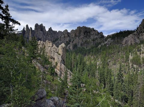
14-mile road through granite spires and one-lane tunnels, including the Needles Eye.

Winding road with pigtail bridges and tunnels that frame Mount Rushmore.
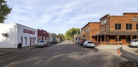
Give Medora and the South Unit of Theodore Roosevelt National Park a full day and an evening for the musical.

Exhibits on Roosevelt's ranching years plus his restored Maltese Cross Cabin.

Paved drive through badlands with bison, wild horses and prairie dog towns.

Steaks speared on pitchforks and cooked in oil on a bluff above town.
Where Medora → Black Hills sits in the full itinerary. Highlighted stops are this leg.
Wildlife drives, painted canyons & granite peaks
This is leg 1 of 2, the opening leg.
Going the other way? Black Hills to Medora is the same 350 km in a straight line, heading north. Reverse directions in Google Maps ↗
The biggest gap comes in May, when Black Hills averages highs 4°C cooler than Medora.
| Measure | Jan | Feb | Mar | Apr | May | Jun | Jul | Aug | Sep | Oct | Nov | Dec |
|---|---|---|---|---|---|---|---|---|---|---|---|---|
| Medora high | -1° | 0° | 7° | 14° | 20° | 26° | 32° | 30° | 23° | 13° | 6° | -1° |
| Black Hills high | 0° | 0° | 6° | 11° | 17° | 24° | 29° | 27° | 21° | 11° | 5° | -1° |
| Medora rain | 11 | 11 | 21 | 37 | 73 | 72 | 53 | 43 | 47 | 29 | 12 | 13 |
| Black Hills rain | 13 | 18 | 27 | 54 | 91 | 71 | 61 | 49 | 40 | 35 | 14 | 14 |
Temperatures in °C, rain in mm per month. Long-term monthly averages from NASA POWER satellite climatology — a guide to typical conditions, not a forecast. Month headings link to Black Hills month guides.
Medora is about 350 km (217 mi) from Black Hills in a straight line, with Black Hills to the south. By road, we estimate 420–490 km (261–304 mi), or 1.2–1.4 times the straight line. Check a maps app for the exact route.
An estimated 4 h 30 min – 7 h 30 min, assuming 420–490 km of road at average speeds of 65–95 km/h with no stops or traffic. It is not a routed time, so check a maps app on the day.
Our Dakotas Badlands & Black Hills itinerary includes this leg. Dakotas Badlands & Black Hills runs about 7 days across 3 stops, best in May – Sep.
Add this leg to a shared itinerary, poll the group on where to stop, split fuel and tickets, and keep everyone's packing list in one place in TripsCircle.