
Harbor views, island hikes and Portuguese lanes
This is leg 2 of 2, the final leg.
 Get the app
Travel leg · Hong Kong, Lantau & Macau
Lantau Island and Macau sit about 41 km (26 mi) apart in a straight line, with Macau to the west. It is leg 2 of 2 on our Hong Kong, Lantau & Macau itinerary, a 6-day trip. It crosses from Hong Kong into Macau. Here is how long it takes by bus, what to see on the way and where it fits in a real itinerary.


Road distance is estimated as 1.2–1.4× the straight line; drive time assumes average speeds of 50–80 km/h with no stops or traffic. These are rough estimates — check a maps app for the actual route.
We don't have live routing data, so the figures below are labelled estimates built from the straight-line distance. Use them to plan the day, then confirm in a maps app.
Our Hong Kong, Lantau & Macau guide points to buses for getting around, and a car works too: an estimated 50–58 km of road and 35 min – 1 h 15 min of driving.
Hong Kong's MTR, trams and ferries are fast and cheap with an Octopus card. Lantau is reached by MTR to Tung Chung, and Macau by TurboJET ferry from Sheung Wan or the bridge bus. In Macau, free casino shuttles and public buses link the peninsula and Taipa.
Picks from our curated guides at both ends.
Former Portuguese enclave of colonial squares, temples and Macanese food. Stay 2 days.
Stone facade of a 17th-century Jesuit church atop a grand stairway.
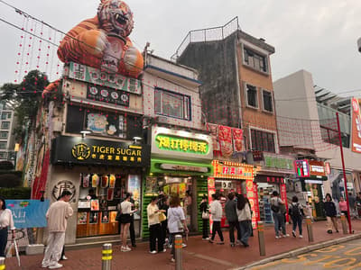
Old lanes of Rua do Cunha with snack shops, Portuguese houses and the Taipa Houses Museum.
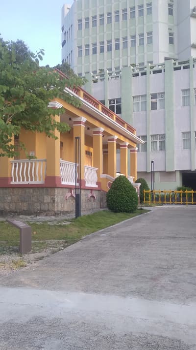
Quiet seaside village with the Chapel of St. Francis Xavier and Hac Sa Beach nearby.
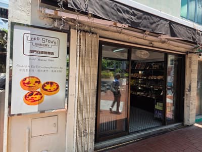
Coloane bakery that made the Portuguese-style egg tart famous in Macau.
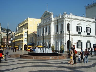
Wave-patterned square lined with pastel colonial buildings and St. Dominic's Church.
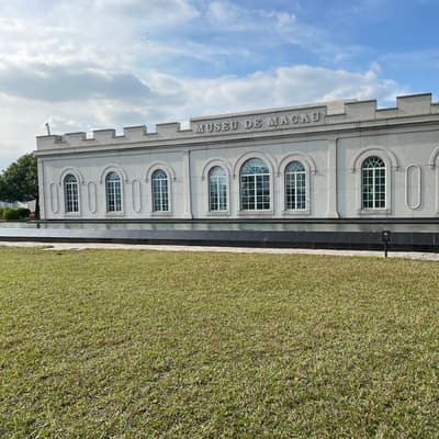
Hilltop fort with cannons and a museum on the city's East-West history.
Hong Kong's largest island, with mountain trails, a giant Buddha and a fishing village. Stay 1 day.
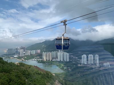
Cable car from Tung Chung over the bay and hills to Ngong Ping plateau.
Bronze Buddha 34 meters tall, reached by 268 steps.

Easy loop trail on the slopes above Ngong Ping with views over the Big Buddha, the airport and the South China Sea.
Where Lantau Island → Macau sits in the full itinerary. Highlighted stops are this leg.
Harbor views, island hikes and Portuguese lanes
This is leg 2 of 2, the final leg.
Going the other way? Macau to Lantau Island is the same 41 km in a straight line, heading east. Reverse directions in Google Maps ↗
Average daytime highs at both ends stay within 1°C of each other all year, so you can pack the same way for both.
| Measure | Jan | Feb | Mar | Apr | May | Jun | Jul | Aug | Sep | Oct | Nov | Dec |
|---|---|---|---|---|---|---|---|---|---|---|---|---|
| Lantau Island high | 18° | 19° | 21° | 24° | 27° | 28° | 29° | 29° | 29° | 27° | 24° | 19° |
| Macau high | 18° | 19° | 21° | 24° | 27° | 29° | 29° | 29° | 29° | 27° | 24° | 20° |
| Lantau Island rain | 35 | 29 | 69 | 109 | 231 | 288 | 197 | 234 | 173 | 55 | 29 | 21 |
| Macau rain | 40 | 31 | 85 | 112 | 247 | 294 | 216 | 253 | 195 | 69 | 32 | 26 |
Temperatures in °C, rain in mm per month. Long-term monthly averages from NASA POWER satellite climatology — a guide to typical conditions, not a forecast. Month headings link to Macau month guides.
Lantau Island is about 41 km (26 mi) from Macau in a straight line, with Macau to the west. By road, we estimate 50–58 km (31–36 mi), or 1.2–1.4 times the straight line. Check a maps app for the exact route.
An estimated 35 min – 1 h 15 min, assuming 50–58 km of road at average speeds of 50–80 km/h with no stops or traffic. It is not a routed time, so check a maps app on the day.
Our Hong Kong, Lantau & Macau itinerary includes this leg. Hong Kong, Lantau & Macau runs about 6 days across 3 stops, best in Oct – Dec.
Add this leg to a shared itinerary, poll the group on where to stop, split fuel and tickets, and keep everyone's packing list in one place in TripsCircle.