


Market mornings, imperial history & lantern nights
This is leg 2 of 2, the final leg.
 Get the app
Travel leg · Central Vietnam Food & Heritage
Hoi An and Hue sit about 103 km (64 mi) apart in a straight line, with Hue to the north-west. It is leg 2 of 2 on our Central Vietnam Food & Heritage itinerary, a 6-day trip. Here is how long it takes by train, what to see on the way and where it fits in a real itinerary.
Road distance is estimated as 1.2–1.4× the straight line; drive time assumes average speeds of 50–80 km/h with no stops or traffic. These are rough estimates — check a maps app for the actual route.
We don't have live routing data, so the figures below are labelled estimates built from the straight-line distance. Use them to plan the day, then confirm in a maps app.
Our Central Vietnam Food & Heritage itinerary is easy to do on public transport, so a train is the likely way to cover this leg. Timetables and direct connections vary — check the operator before you book.
Driving is an estimated 123–144 km (77–89 mi) and 1 h 30 min – 3 h at typical average speeds, not a routed time.
The three cities are linked by road along the coast, and most travelers use private cars, shuttle buses or trains for the hops between them. Within each city, taxis, ride-hailing apps, bicycles and walking are common ways to get around.
Picks from our curated guides at both ends, plus 8 places near the straight-line path.
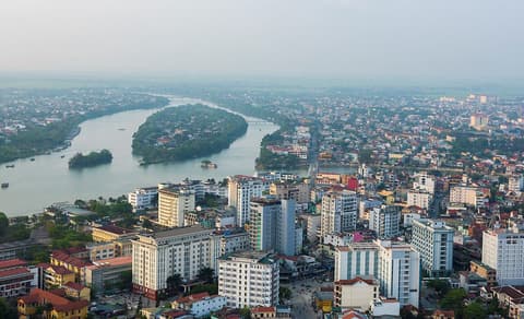
Give it two days: the Citadel one day, royal tombs and the river the next, with Hue's spicy dishes throughout.

Walled Nguyen dynasty citadel with the Forbidden Purple City and restored palaces.

Hue's main market near the Citadel; try bún bò Huế and bánh bèo at food stalls.

Slow boat ride on the Perfume River between the city and Thien Mu.

Hue's salt coffee: strong coffee topped with salted cream, a local invention.

Local spot for Hue rice cakes: bánh khoái, bánh bèo, bánh nậm and nem lụi.

Seven-story octagonal tower on a bluff above the Perfume River.
These places from our other itineraries sit within about 15 km of the straight line between Hoi An and Hue. The road may not pass them directly, so check how far off your route they are.

Long city beach with gentle surf and seafood restaurants across the road.

Son Tra Peninsula pagoda with a 67-meter Lady Buddha statue facing the bay.

Dragon-shaped bridge over the Han River that breathes fire and water on weekend nights.

Largest collection of Cham sandstone carvings from My Son and other temple sites.

Retro-style café chain; the coconut coffee is the signature order.

Two-floor downtown market for dried seafood, fruit and snack stalls.

Alley restaurant for crispy bánh xèo rolled in rice paper with herbs and liver-peanut sauce.

Long-running shop devoted to mì Quảng, turmeric noodles with shrimp, pork and peanuts.
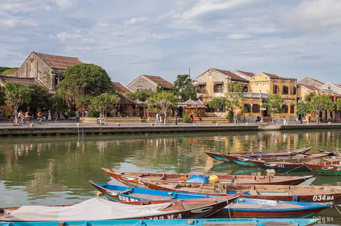
Stay two to three nights: old-town houses and food stalls by day, lanterns at night, a beach or countryside morning.
Where Hoi An → Hue sits in the full itinerary. Highlighted stops are this leg.
Market mornings, imperial history & lantern nights
This is leg 2 of 2, the final leg.
Going the other way? Hue to Hoi An is the same 103 km in a straight line, heading south-east. Reverse directions in Google Maps ↗
Average daytime highs at both ends stay within 1°C of each other all year, so you can pack the same way for both.
| Measure | Jan | Feb | Mar | Apr | May | Jun | Jul | Aug | Sep | Oct | Nov | Dec |
|---|---|---|---|---|---|---|---|---|---|---|---|---|
| Hoi An high | 24° | 26° | 28° | 31° | 32° | 33° | 33° | 32° | 31° | 29° | 27° | 25° |
| Hue high | 24° | 26° | 28° | 31° | 32° | 33° | 33° | 32° | 31° | 29° | 27° | 25° |
| Hoi An rain | 79 | 27 | 39 | 49 | 81 | 71 | 102 | 167 | 371 | 562 | 412 | 249 |
| Hue rain | 74 | 28 | 40 | 54 | 86 | 72 | 106 | 175 | 381 | 560 | 370 | 215 |
Temperatures in °C, rain in mm per month. Long-term monthly averages from NASA POWER satellite climatology — a guide to typical conditions, not a forecast. Month headings link to Hue month guides.
Hoi An is about 103 km (64 mi) from Hue in a straight line, with Hue to the north-west. By road, we estimate 123–144 km (77–89 mi), or 1.2–1.4 times the straight line. Check a maps app for the exact route.
An estimated 1 h 30 min – 3 h, assuming 123–144 km of road at average speeds of 50–80 km/h with no stops or traffic. It is not a routed time, so check a maps app on the day. Our itinerary leans on rail, so check train times too.
Near the straight-line path we have 8 places from our curated guides, including My Khe Beach (Da Nang), Linh Ung Pagoda (Da Nang), Dragon Bridge (Da Nang), Museum of Cham Sculpture (Da Nang). The road may not pass them directly, so check the detour.
Our Central Vietnam Food & Heritage itinerary includes this leg. Central Vietnam Food & Heritage runs about 6 days across 3 stops, best in Feb – Apr.
Add this leg to a shared itinerary, poll the group on where to stop, split fuel and tickets, and keep everyone's packing list in one place in TripsCircle.