


Market mornings, imperial history & lantern nights
This is leg 1 of 2, the opening leg.
 Get the app
Travel leg · Central Vietnam Food & Heritage
Da Nang and Hoi An sit about 24 km (15 mi) apart in a straight line, with Hoi An to the south-east. It is leg 1 of 2 on our Central Vietnam Food & Heritage itinerary, a 6-day trip. Here is how long it takes by train, what to see on the way and where it fits in a real itinerary.

Road distance is estimated as 1.2–1.4× the straight line; drive time assumes average speeds of 50–80 km/h with no stops or traffic. These are rough estimates — check a maps app for the actual route.
We don't have live routing data, so the figures below are labelled estimates built from the straight-line distance. Use them to plan the day, then confirm in a maps app.
Our Central Vietnam Food & Heritage itinerary is easy to do on public transport, so a train is the likely way to cover this leg. Timetables and direct connections vary — check the operator before you book.
Driving is an estimated 29–34 km (18–21 mi) and 20–40 min at typical average speeds, not a routed time.
The three cities are linked by road along the coast, and most travelers use private cars, shuttle buses or trains for the hops between them. Within each city, taxis, ride-hailing apps, bicycles and walking are common ways to get around.
Picks from our curated guides at both ends.
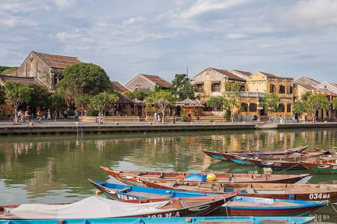
Stay two to three nights: old-town houses and food stalls by day, lanterns at night, a beach or countryside morning.

Late-1500s covered bridge with a small temple, the old town's landmark.

Famous bánh mì stand with many filling combinations.

Silent teahouse staffed by speech- and hearing-impaired staff; order with wooden blocks.

Riverside village of potters making terracotta wares; try the wheel.

Relaxed beach with seafood shacks and loungers 4 km from town.

Two-century-old merchant house blending Japanese, Chinese and Vietnamese design.
Spend two days: noodle breakfasts and markets in town, Son Tra and Marble Mountains, and an evening by the Dragon Bridge.
Where Da Nang → Hoi An sits in the full itinerary. Highlighted stops are this leg.
Market mornings, imperial history & lantern nights
This is leg 1 of 2, the opening leg.
Going the other way? Hoi An to Da Nang is the same 24 km in a straight line, heading north-west. Reverse directions in Google Maps ↗
Da Nang is about 24 km (15 mi) from Hoi An in a straight line, with Hoi An to the south-east. By road, we estimate 29–34 km (18–21 mi), or 1.2–1.4 times the straight line. Check a maps app for the exact route.
An estimated 20–40 min, assuming 29–34 km of road at average speeds of 50–80 km/h with no stops or traffic. It is not a routed time, so check a maps app on the day. Our itinerary leans on rail, so check train times too.
Our Central Vietnam Food & Heritage itinerary includes this leg. Central Vietnam Food & Heritage runs about 6 days across 3 stops, best in Feb – Apr.
Add this leg to a shared itinerary, poll the group on where to stop, split fuel and tickets, and keep everyone's packing list in one place in TripsCircle.