


Pubs, bogland, sea cliffs and trad music
This is leg 2 of 3.
 Get the app
Travel leg · Dublin to the Wild Atlantic Way
Galway and Connemara sit about 68 km (42 mi) apart in a straight line, with Connemara to the west. It is leg 2 of 3 on our Dublin to the Wild Atlantic Way itinerary, a 9-day trip. Here is how long it takes by car, what to see on the way and where it fits in a real itinerary.


Road distance is estimated as 1.2–1.4× the straight line; drive time assumes average speeds of 50–80 km/h with no stops or traffic. These are rough estimates — check a maps app for the actual route.
We don't have live routing data, so the figures below are labelled estimates built from the straight-line distance. Use them to plan the day, then confirm in a maps app.
Most travelers on our Dublin to the Wild Atlantic Way itinerary do this leg by car. We estimate 82–96 km (51–59 mi) of road and 1 h – 2 h behind the wheel, so check live traffic before you set off.
Our Dublin to the Wild Atlantic Way guide also mentions trains for parts of the trip. Whether a direct train links Galway and Connemara depends on the line — check timetables.
Use trams and walk in Dublin, then take the train to Galway and pick up a hire car there. A car is needed for Connemara and the Burren; roads are narrow and you drive on the left.
Picks from our curated guides at both ends.
Lakes, bog and mountains; base in Clifden for 2 nights.

Lakeside castle-style abbey with a Victorian walled garden.

Moorland park with free trails; Diamond Hill gives views to the islands.
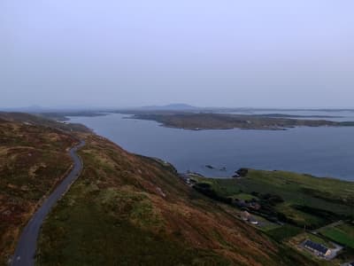
Loop drive west of Clifden on high ground over Atlantic inlets and islands.

Seafood restaurant with open fires; fish arrives daily from local boats.

Music and whiskey bar with a long Irish whiskey list and trad sessions.

Long sea inlet between mountains; cruises run from Nancy's Point near Leenane.
Lively harbor city; 2 nights for pubs, the Latin Quarter and an Aran Islands day trip.
Where Galway → Connemara sits in the full itinerary. Highlighted stops are this leg.
Pubs, bogland, sea cliffs and trad music
This is leg 2 of 3.
Going the other way? Connemara to Galway is the same 68 km in a straight line, heading east. Reverse directions in Google Maps ↗
The biggest gap comes in June, when Connemara averages highs 4°C cooler than Galway. Over a year, Connemara gets about 270 mm more rain.
| Measure | Jan | Feb | Mar | Apr | May | Jun | Jul | Aug | Sep | Oct | Nov | Dec |
|---|---|---|---|---|---|---|---|---|---|---|---|---|
| Galway high | 8° | 8° | 10° | 13° | 16° | 19° | 20° | 19° | 17° | 14° | 10° | 8° |
| Connemara high | 9° | 8° | 9° | 11° | 13° | 15° | 17° | 17° | 16° | 13° | 11° | 9° |
| Galway rain | 108 | 84 | 81 | 68 | 81 | 89 | 97 | 105 | 86 | 104 | 118 | 113 |
| Connemara rain | 143 | 112 | 100 | 79 | 92 | 95 | 113 | 122 | 112 | 129 | 151 | 152 |
Temperatures in °C, rain in mm per month. Long-term monthly averages from NASA POWER satellite climatology — a guide to typical conditions, not a forecast. Month headings link to Connemara month guides.
Galway is about 68 km (42 mi) from Connemara in a straight line, with Connemara to the west. By road, we estimate 82–96 km (51–59 mi), or 1.2–1.4 times the straight line. Check a maps app for the exact route.
An estimated 1 h – 2 h, assuming 82–96 km of road at average speeds of 50–80 km/h with no stops or traffic. It is not a routed time, so check a maps app on the day.
Our Dublin to the Wild Atlantic Way itinerary includes this leg. Dublin to the Wild Atlantic Way runs about 9 days across 4 stops, best in May – Sep.
Add this leg to a shared itinerary, poll the group on where to stop, split fuel and tickets, and keep everyone's packing list in one place in TripsCircle.