


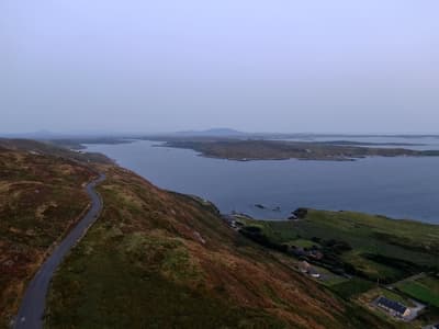
Pubs, bogland, sea cliffs and trad music
This is leg 3 of 3, the final leg.
 Get the app
Travel leg · Dublin to the Wild Atlantic Way
Connemara and Doolin & the Cliffs of Moher sit about 68 km (42 mi) apart in a straight line, with Doolin & the Cliffs of Moher to the south-east. It is leg 3 of 3 on our Dublin to the Wild Atlantic Way itinerary, a 9-day trip. Here is how long it takes by car, what to see on the way and where it fits in a real itinerary.


Road distance is estimated as 1.2–1.4× the straight line; drive time assumes average speeds of 50–80 km/h with no stops or traffic. These are rough estimates — check a maps app for the actual route.
We don't have live routing data, so the figures below are labelled estimates built from the straight-line distance. Use them to plan the day, then confirm in a maps app.
Most travelers on our Dublin to the Wild Atlantic Way itinerary do this leg by car. We estimate 81–95 km (51–59 mi) of road and 1 h – 2 h behind the wheel, so check live traffic before you set off.
Our Dublin to the Wild Atlantic Way guide also mentions trains for parts of the trip. Whether a direct train links Connemara and Doolin depends on the line — check timetables.
Use trams and walk in Dublin, then take the train to Galway and pick up a hire car there. A car is needed for Connemara and the Burren; roads are narrow and you drive on the left.
Picks from our curated guides at both ends, plus 1 place near the straight-line path.
Music village on the Clare coast; stay 2 nights for cliffs and the Burren.

Sea cliffs rising over 200m above the Atlantic, with a visitor centre and path.

Guided or self-led walk from Doolin along the clifftop to the Cliffs of Moher.

Cave tour to the Great Stalactite, one of the longest free-hanging stalactites.

Michelin-starred cottage restaurant near Doolin with a short tasting menu built on Clare produce.

Fisher Street pub with trad music sessions nightly through the year.

Neolithic portal tomb on the bare limestone of the Burren.
These places from our other itineraries sit within about 10 km of the straight line between Connemara and Doolin. The road may not pass them directly, so check how far off your route they are.
Lakes, bog and mountains; base in Clifden for 2 nights.
Where Connemara → Doolin sits in the full itinerary. Highlighted stops are this leg.
Pubs, bogland, sea cliffs and trad music
This is leg 3 of 3, the final leg.
Going the other way? Doolin & the Cliffs of Moher to Connemara is the same 68 km in a straight line, heading north-west. Reverse directions in Google Maps ↗
Average daytime highs at both ends stay within 1°C of each other all year, so you can pack the same way for both.
| Measure | Jan | Feb | Mar | Apr | May | Jun | Jul | Aug | Sep | Oct | Nov | Dec |
|---|---|---|---|---|---|---|---|---|---|---|---|---|
| Connemara high | 9° | 8° | 9° | 11° | 13° | 15° | 17° | 17° | 16° | 13° | 11° | 9° |
| Doolin high | 9° | 8° | 9° | 11° | 14° | 16° | 17° | 17° | 16° | 14° | 11° | 9° |
| Connemara rain | 143 | 112 | 100 | 79 | 92 | 95 | 113 | 122 | 112 | 129 | 151 | 152 |
| Doolin rain | 134 | 105 | 95 | 76 | 87 | 90 | 104 | 111 | 103 | 117 | 149 | 142 |
Temperatures in °C, rain in mm per month. Long-term monthly averages from NASA POWER satellite climatology — a guide to typical conditions, not a forecast. Month headings link to Doolin & the Cliffs of Moher month guides.
Connemara is about 68 km (42 mi) from Doolin & the Cliffs of Moher in a straight line, with Doolin & the Cliffs of Moher to the south-east. By road, we estimate 81–95 km (51–59 mi), or 1.2–1.4 times the straight line. Check a maps app for the exact route.
An estimated 1 h – 2 h, assuming 81–95 km of road at average speeds of 50–80 km/h with no stops or traffic. It is not a routed time, so check a maps app on the day.
Near the straight-line path we have 1 place from our curated guides, including Inis Mór (Galway). The road may not pass them directly, so check the detour.
Our Dublin to the Wild Atlantic Way itinerary includes this leg. Dublin to the Wild Atlantic Way runs about 9 days across 4 stops, best in May – Sep.
Add this leg to a shared itinerary, poll the group on where to stop, split fuel and tickets, and keep everyone's packing list in one place in TripsCircle.