
Sun, sand & tropical vibes
This is leg 2 of 2, the final leg.
 Get the app
Travel leg · Miami Beach Getaway
Everglades and Key West sit about 120 km (75 mi) apart in a straight line, with Key West to the south-west. It is leg 2 of 2 on our Miami Beach Getaway itinerary, a 5-day trip. Here is how long it takes by car, what to see on the way and where it fits in a real itinerary.


Road distance is estimated as 1.2–1.4× the straight line; drive time assumes average speeds of 65–95 km/h with no stops or traffic. These are rough estimates — check a maps app for the actual route.
We don't have live routing data, so the figures below are labelled estimates built from the straight-line distance. Use them to plan the day, then confirm in a maps app.
Most travelers on our Miami Beach Getaway itinerary do this leg by car. We estimate 145–169 km (90–105 mi) of road and 1 h 30 min – 2 h 30 min behind the wheel, so check live traffic before you set off.
Rent a car for this one. The Everglades sit a short drive from Miami, and the road down the Keys is a famously scenic run with bridges and water on both sides. South Beach itself is walkable, with ride shares and rentable bikes for short hops.
Picks from our curated guides at both ends, plus 2 places near the straight-line path.
Spend 2 days: walk Old Town's history stops by day, catch the Mallory Square sunset and end on Duval Street.

Hemingway's 1930s home with guided tours and dozens of six-toed cats.

Civil War fort with the best swimming beach in town and shade under pine trees.
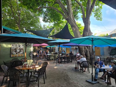
Bahama Village garden restaurant with roosters underfoot; famous for breakfast and tall key lime pie.
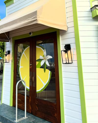
Key lime pie on a stick (chocolate-dipped, frozen) and key lime goods.

Nightly sunset gathering on the harbor with street performers and food carts.
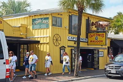
The original Sloppy Joe's location (1930s), with a tree growing through the roof and live music.
These places from our other itineraries sit within about 18 km of the straight line between Everglades and Key West. The road may not pass them directly, so check how far off your route they are.
A pizza and beer stop on a back road of Big Pine Key, its walls covered in signed dollar bills.
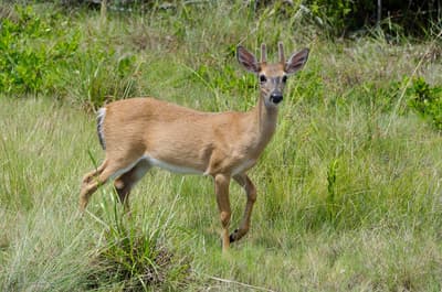
A freshwater pond in an old quarry in the National Key Deer Refuge, where small Key deer and alligators are often seen.
Give it a full day from Homestead: Royal Palm boardwalks, the drive to Flamingo, and an airboat or tram ride on the north side.

Family farm stand since 1959 near the park entrance; get a key lime or mamey milkshake.

Main park entrance with exhibits and ranger info on what's active that day.
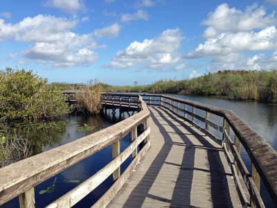
Short boardwalk at Royal Palm where alligators, anhingas and herons are often a few feet away.
Where Everglades → Key West sits in the full itinerary. Highlighted stops are this leg.
Sun, sand & tropical vibes
This is leg 2 of 2, the final leg.
Going the other way? Key West to Everglades is the same 120 km in a straight line, heading north-east. Reverse directions in Google Maps ↗
Average daytime highs at both ends stay within 1°C of each other all year, so you can pack the same way for both. Over a year, Everglades gets about 250 mm more rain.
| Measure | Jan | Feb | Mar | Apr | May | Jun | Jul | Aug | Sep | Oct | Nov | Dec |
|---|---|---|---|---|---|---|---|---|---|---|---|---|
| Everglades high | 22° | 24° | 25° | 27° | 28° | 30° | 30° | 30° | 30° | 28° | 26° | 24° |
| Key West high | 23° | 23° | 24° | 26° | 27° | 29° | 30° | 30° | 29° | 28° | 26° | 24° |
| Everglades rain | 37 | 42 | 42 | 68 | 122 | 203 | 184 | 193 | 202 | 109 | 55 | 45 |
| Key West rain | 33 | 34 | 26 | 44 | 96 | 157 | 127 | 156 | 177 | 116 | 49 | 39 |
Temperatures in °C, rain in mm per month. Long-term monthly averages from NASA POWER satellite climatology — a guide to typical conditions, not a forecast. Month headings link to Key West month guides.
Everglades is about 120 km (75 mi) from Key West in a straight line, with Key West to the south-west. By road, we estimate 145–169 km (90–105 mi), or 1.2–1.4 times the straight line. Check a maps app for the exact route.
An estimated 1 h 30 min – 2 h 30 min, assuming 145–169 km of road at average speeds of 65–95 km/h with no stops or traffic. It is not a routed time, so check a maps app on the day.
Near the straight-line path we have 2 places from our curated guides, including No Name Pub (Bahia Honda & the Lower Keys), Blue Hole (Bahia Honda & the Lower Keys). The road may not pass them directly, so check the detour.
Our Miami Beach Getaway itinerary includes this leg. Miami Beach Getaway runs about 5 days across 3 stops, best in Nov – Apr.
Add this leg to a shared itinerary, poll the group on where to stop, split fuel and tickets, and keep everyone's packing list in one place in TripsCircle.