


Caves, lake country & mountain towns
This is leg 2 of 2, the final leg.
 Get the app
Travel leg · Ozarks Hidden Gems
Branson and Eureka Springs sit about 54 km (33 mi) apart in a straight line, with Eureka Springs to the south-west. It is leg 2 of 2 on our Ozarks Hidden Gems itinerary, a 5-day trip. Here is how long it takes by car, what to see on the way and where it fits in a real itinerary.
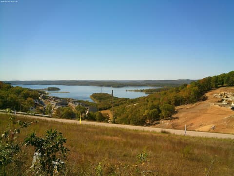
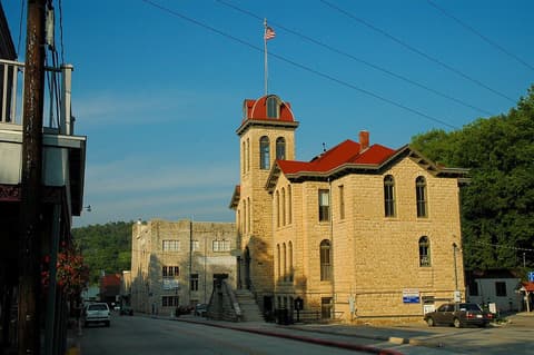
Road distance is estimated as 1.2–1.4× the straight line; drive time assumes average speeds of 50–80 km/h with no stops or traffic. These are rough estimates — check a maps app for the actual route.
We don't have live routing data, so the figures below are labelled estimates built from the straight-line distance. Use them to plan the day, then confirm in a maps app.
Most travelers on our Ozarks Hidden Gems itinerary do this leg by car. We estimate 64–75 km (40–47 mi) of road and 50 min – 1 h 30 min behind the wheel, so check live traffic before you set off.
You will want a car here. The stops are linked by winding two-lane roads through hills and past lakes, and public transit is limited. Eureka Springs is the one place where parking once and walking pays off.
Picks from our curated guides at both ends.
Overnight here: a morning in the steep Victorian streets, an afternoon at Thorncrown and the lake, dinner downtown.

Fay Jones's glass-and-timber chapel set in the forest.

Spring-fed lake with hiking and mountain biking trails close to town.
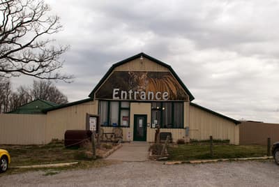
Sanctuary for rescued big cats with guided tours.

Main Street café with a balcony over the street, good for brunch.

Craft brewery with a wooded beer garden and live music.

Small park at the center of the historic district where the town began.
Spend 2 days: one at Silver Dollar City, one on Table Rock Lake and the Big Cedar area.
Where Branson → Eureka Springs sits in the full itinerary. Highlighted stops are this leg.
Caves, lake country & mountain towns
This is leg 2 of 2, the final leg.
Going the other way? Eureka Springs to Branson is the same 54 km in a straight line, heading north-east. Reverse directions in Google Maps ↗
Average daytime highs at both ends stay within 1°C of each other all year, so you can pack the same way for both.
| Measure | Jan | Feb | Mar | Apr | May | Jun | Jul | Aug | Sep | Oct | Nov | Dec |
|---|---|---|---|---|---|---|---|---|---|---|---|---|
| Branson high | 7° | 9° | 15° | 21° | 25° | 30° | 33° | 33° | 29° | 22° | 15° | 9° |
| Eureka Springs high | 6° | 8° | 14° | 20° | 24° | 29° | 33° | 32° | 28° | 21° | 14° | 8° |
| Branson rain | 67 | 75 | 113 | 134 | 139 | 98 | 100 | 94 | 93 | 106 | 88 | 75 |
| Eureka Springs rain | 64 | 68 | 109 | 130 | 149 | 104 | 97 | 95 | 97 | 109 | 80 | 70 |
Temperatures in °C, rain in mm per month. Long-term monthly averages from NASA POWER satellite climatology — a guide to typical conditions, not a forecast. Month headings link to Eureka Springs month guides.
Branson is about 54 km (33 mi) from Eureka Springs in a straight line, with Eureka Springs to the south-west. By road, we estimate 64–75 km (40–47 mi), or 1.2–1.4 times the straight line. Check a maps app for the exact route.
An estimated 50 min – 1 h 30 min, assuming 64–75 km of road at average speeds of 50–80 km/h with no stops or traffic. It is not a routed time, so check a maps app on the day.
Our Ozarks Hidden Gems itinerary includes this leg. Ozarks Hidden Gems runs about 5 days across 3 stops, best in Apr – Oct.
Add this leg to a shared itinerary, poll the group on where to stop, split fuel and tickets, and keep everyone's packing list in one place in TripsCircle.