
Southern coast culture trail
This is leg 2 of 2, the final leg.
 Get the app
Travel leg · Charleston & Savannah
Beaufort and Savannah sit about 56 km (35 mi) apart in a straight line, with Savannah to the south-west. It is leg 2 of 2 on our Charleston & Savannah itinerary, a 5-day trip. Here is how long it takes by car, what to see on the way and where it fits in a real itinerary.

Road distance is estimated as 1.2–1.4× the straight line; drive time assumes average speeds of 50–80 km/h with no stops or traffic. These are rough estimates — check a maps app for the actual route.
We don't have live routing data, so the figures below are labelled estimates built from the straight-line distance. Use them to plan the day, then confirm in a maps app.
Most travelers on our Charleston & Savannah itinerary do this leg by car. We estimate 67–78 km (41–48 mi) of road and 50 min – 1 h 30 min behind the wheel, so check live traffic before you set off.
Charleston and Savannah are linked by road, and a rental car makes it easy to include Beaufort along the way. Both cities are very walkable in their historic centers, so you can park once and explore on foot. Ride shares and tours help for longer hops.
Picks from our curated guides at both ends.
Give Savannah 2 days to walk the squares, eat Southern classics and visit Bonaventure.
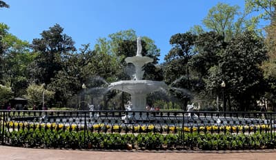
30-acre park with the famous white fountain under Spanish moss.
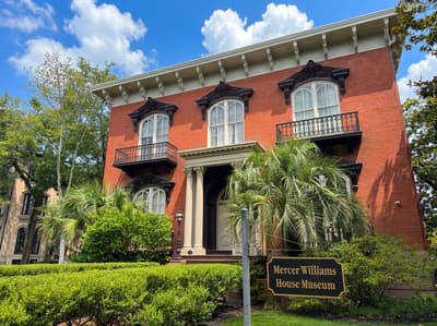
Italianate mansion on Monterey Square made famous by Midnight in the Garden of Good and Evil.
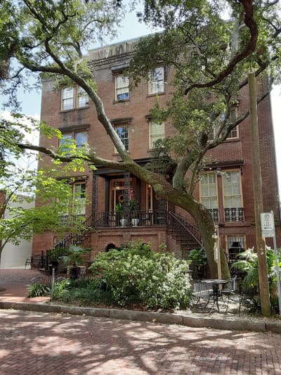
Boardinghouse-style lunch since 1943: fried chicken and a dozen sides at shared tables.

Veteran-owned brewery west of downtown with a dog-friendly taproom and rotating small-batch beers.
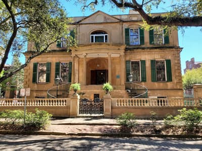
Regency house museum with one of the South's best-preserved urban slave quarters.

Southern dinner in a 1771 mansion; Planters Tavern downstairs has a piano bar.
A slower half-day to overnight stop: walk the waterfront and historic district, then drive out to Hunting Island.

Riverfront lawns and swings facing the Beaufort River and Woods Memorial Bridge.

1804 Federal-style house museum on Bay Street run by Historic Beaufort Foundation.

Local market and café for shrimp and grits, pimento cheese and pies.
Where Beaufort → Savannah sits in the full itinerary. Highlighted stops are this leg.
Southern coast culture trail
This is leg 2 of 2, the final leg.
Going the other way? Savannah to Beaufort is the same 56 km in a straight line, heading north-east. Reverse directions in Google Maps ↗
The biggest gap comes in May, when Savannah averages highs 2°C warmer than Beaufort.
| Measure | Jan | Feb | Mar | Apr | May | Jun | Jul | Aug | Sep | Oct | Nov | Dec |
|---|---|---|---|---|---|---|---|---|---|---|---|---|
| Beaufort high | 14° | 16° | 19° | 23° | 27° | 30° | 31° | 31° | 29° | 25° | 20° | 16° |
| Savannah high | 15° | 17° | 21° | 25° | 29° | 31° | 33° | 32° | 30° | 26° | 21° | 17° |
| Beaufort rain | 63 | 79 | 83 | 75 | 90 | 140 | 136 | 154 | 100 | 87 | 59 | 86 |
| Savannah rain | 62 | 75 | 82 | 76 | 89 | 149 | 131 | 160 | 103 | 89 | 53 | 82 |
Temperatures in °C, rain in mm per month. Long-term monthly averages from NASA POWER satellite climatology — a guide to typical conditions, not a forecast. Month headings link to Savannah month guides.
Beaufort is about 56 km (35 mi) from Savannah in a straight line, with Savannah to the south-west. By road, we estimate 67–78 km (41–48 mi), or 1.2–1.4 times the straight line. Check a maps app for the exact route.
An estimated 50 min – 1 h 30 min, assuming 67–78 km of road at average speeds of 50–80 km/h with no stops or traffic. It is not a routed time, so check a maps app on the day.
Our Charleston & Savannah itinerary includes this leg. Charleston & Savannah runs about 5 days across 3 stops, best in Mar – May.
Add this leg to a shared itinerary, poll the group on where to stop, split fuel and tickets, and keep everyone's packing list in one place in TripsCircle.