
Franconian Christmas markets by train
This is leg 2 of 2, the final leg.
 Get the app
Travel leg · Würzburg, Bamberg & Nuremberg
Bamberg and Nuremberg sit about 51 km (31 mi) apart in a straight line, with Nuremberg to the south. It is leg 2 of 2 on our Würzburg, Bamberg & Nuremberg itinerary, a 5-day trip. Here is how long it takes by train, what to see on the way and where it fits in a real itinerary.

Road distance is estimated as 1.2–1.4× the straight line; drive time assumes average speeds of 50–80 km/h with no stops or traffic. These are rough estimates — check a maps app for the actual route.
We don't have live routing data, so the figures below are labelled estimates built from the straight-line distance. Use them to plan the day, then confirm in a maps app.
Our Würzburg, Bamberg & Nuremberg itinerary is planned around rail, so a train is the likely way to cover this leg. Timetables and direct connections vary — check the operator before you book.
Driving is an estimated 61–71 km (38–44 mi) and 45 min – 1 h 30 min at typical average speeds, not a routed time.
Fly into Frankfurt and take the ICE to Würzburg (about 1.5 hours from the airport), or fly into Nuremberg, whose airport is 12 minutes from the main station by U-Bahn, and do the loop in reverse. Würzburg to Bamberg is about an hour by regional train, and Bamberg to Nuremberg 40 minutes to an hour. A Bayern-Ticket covers a day of regional trains for one to five people, and all three old towns are walkable from their stations.
Picks from our curated guides at both ends.
The Christkindlesmarkt, bratwurst and the Kaiserburg; 2 nights.

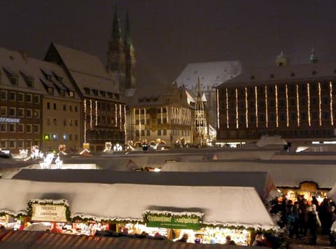
Around 180 red-and-white striped stalls fill the Hauptmarkt, selling Lebkuchen, plum-people figures and Glühwein.

Stalls from Nuremberg's twin cities around the world on the Rathausplatz, beside St. Sebaldus.

The imperial castle on the sandstone ridge above the old town, with the Sinwell Tower and a 50-metre well.
Grill house beside St. Sebaldus serving finger-sized Nürnberger Rostbratwürste over a beechwood fire.
Gothic church on the Hauptmarkt whose 1509 clock runs the Männleinlaufen figure parade every day at noon.
A 14th-century spire-shaped fountain at the corner of the Hauptmarkt, with a brass ring set in its railing.
UNESCO old town of smoked beer and river houses; 1–2 nights.

The old town hall stands on an island in the Regnitz, half-timbered on one end and covered in painted facades.

Prince-bishops' palace on the Domplatz; its rose garden terrace looks across the roofs to Michaelsberg.

Historic brewery tavern pouring Aecht Schlenkerla Rauchbier, a smoked beer, from wooden barrels.
Where Bamberg → Nuremberg sits in the full itinerary. Highlighted stops are this leg.
Franconian Christmas markets by train
This is leg 2 of 2, the final leg.
Going the other way? Nuremberg to Bamberg is the same 51 km in a straight line, heading north. Reverse directions in Google Maps ↗
Average daytime highs at both ends stay within 1°C of each other all year, so you can pack the same way for both.
| Measure | Jan | Feb | Mar | Apr | May | Jun | Jul | Aug | Sep | Oct | Nov | Dec |
|---|---|---|---|---|---|---|---|---|---|---|---|---|
| Bamberg high | 2° | 4° | 9° | 15° | 19° | 24° | 26° | 26° | 21° | 14° | 8° | 3° |
| Nuremberg high | 2° | 4° | 9° | 15° | 19° | 24° | 26° | 26° | 21° | 14° | 8° | 3° |
| Bamberg rain | 60 | 47 | 49 | 38 | 73 | 62 | 78 | 67 | 54 | 55 | 61 | 65 |
| Nuremberg rain | 58 | 44 | 48 | 39 | 76 | 69 | 77 | 72 | 55 | 52 | 57 | 60 |
Temperatures in °C, rain in mm per month. Long-term monthly averages from NASA POWER satellite climatology — a guide to typical conditions, not a forecast. Month headings link to Nuremberg month guides.
Bamberg is about 51 km (31 mi) from Nuremberg in a straight line, with Nuremberg to the south. By road, we estimate 61–71 km (38–44 mi), or 1.2–1.4 times the straight line. Check a maps app for the exact route.
An estimated 45 min – 1 h 30 min, assuming 61–71 km of road at average speeds of 50–80 km/h with no stops or traffic. It is not a routed time, so check a maps app on the day. Our itinerary leans on rail, so check train times too.
Our Würzburg, Bamberg & Nuremberg itinerary includes this leg. Würzburg, Bamberg & Nuremberg runs about 5 days across 3 stops, best in Late Nov – Dec 23.
Add this leg to a shared itinerary, poll the group on where to stop, split fuel and tickets, and keep everyone's packing list in one place in TripsCircle.