

Outdoors Astoria
Fort Stevens State Park
An outdoor spot in Astoria, budget-friendly ($) and worth about 2.5 hours. Best time to go: Low tide.
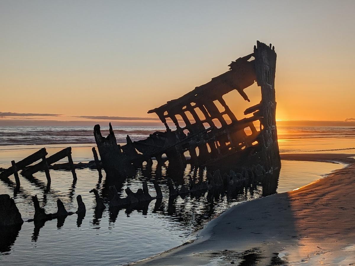
Why go
Civil War-era fort, bike trails and the rusted wreck of the Peter Iredale on the beach.
It is one of 9 curated places we feature in Astoria, alongside 3 sights, 2 bars & cafés and 2 places to eat. The closest of our other picks is Flavel House Museum, 6.7 mi away as the crow flies.
- Type
- Outdoors · Beaches
- Price
- $
- Time needed
- 2.5 hr
- Best time
- Low tide
Nearby
The 6 closest curated picks in Astoria, measured as straight-line distance.
- 1Flavel House Museum
1885 Queen Anne mansion of a river bar pilot, furnished in period style.
Sight · 6.7 mi straight-line - 2Buoy Beer Company
Brewpub on a cannery pier with a glass floor panel over sea lions below.
Drinks · 7.0 mi straight-line - 3Fort George Brewery
Brewery and pizza-and-pub-food spot in a 1920s auto garage downtown.
Drinks · 7.1 mi straight-line - 4Blue Scorcher Bakery Café
Worker-owned bakery for breads, pastries and breakfast with organic ingredients.
Food · 7.1 mi straight-line - 5Bowpicker Fish & Chips
Albacore tuna fish and chips served from a converted gillnet boat.
Food · 7.2 mi straight-line - 6Columbia River Maritime Museum
Museum on the 'Graveyard of the Pacific' river bar, with a lightship you can board.
Sight · 7.3 mi straight-line
On these curated routes
Fort Stevens State Park is a stop on our Oregon Coast Hideaways route. Open it to see the full day-by-day plan.

More to do in Astoria
Fort Stevens State Park is our only outdoors pick in Astoria; here is what else we recommend there. See the full Astoria guide.

When to go
Average daily highs in Astoria run from 47°F in December to 68°F in August; December is usually the wettest month. For Fort Stevens State Park itself, we suggest: Low tide.
Modelled monthly averages for Astoria from NASA POWER, not a forecast. Full Astoria weather by month.
Getting there
Map links open a live search for Fort Stevens State Park, so hours and directions come straight from the map app.
- Address
- 1675 Peter Iredale Rd, Hammond, OR 97121, USA
- Coordinates
- 46.18886, -123.97614
- Destination
- Astoria, Oregon
Fort Stevens State Park: quick answers
How much time do you need at Fort Stevens State Park?
Plan on about 2.5 hours at Fort Stevens State Park. That is our curated estimate for a typical visit; groups that linger will want more.
When is the best time to visit Fort Stevens State Park?
Our pick: Low tide. Insider tip: Low tide lets you walk right up to the wreck.
Where is Fort Stevens State Park?
Fort Stevens State Park is at 1675 Peter Iredale Rd, Hammond, OR 97121, USA. The Google Maps and Apple Maps links on this page open it for directions.
Which TripsCircle routes include Fort Stevens State Park?
Fort Stevens State Park appears on Oregon Coast Hideaways, a curated route you can open on TripsCircle and plan with your group.
Add Fort Stevens State Park to your crew's plan
Save it to a shared TripsCircle itinerary, settle the timing with a quick poll, and split the costs with everyone going to Astoria.
Plan Astoria
- Astoria travel guide 9 places
- Best time to visit Astoria weather by month
- Astoria to Cannon Beach 21 mi straight-line
Lists & regions
Also in Astoria
- Astoria Riverwalk Activity
- Astoria Column Sight
Curated recommendation, not live listing data. Confirm hours, prices, bookings and access before you go.