
Big skies, geothermal wonders & alpine lakes
This is leg 2 of 2, the final leg.
 Get the app
Travel leg · Glacier to Yellowstone
Yellowstone National Park and Grand Teton National Park sit about 71 km (44 mi) apart in a straight line, with Grand Teton National Park to the south. It is leg 2 of 2 on our Glacier to Yellowstone itinerary, an 8-day trip. Here is how long it takes by car, what to see on the way and where it fits in a real itinerary.
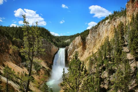

Road distance is estimated as 1.2–1.4× the straight line; drive time assumes average speeds of 50–80 km/h with no stops or traffic. These are rough estimates — check a maps app for the actual route.
We don't have live routing data, so the figures below are labelled estimates built from the straight-line distance. Use them to plan the day, then confirm in a maps app.
Most travelers on our Glacier to Yellowstone itinerary do this leg by car. We estimate 86–100 km (53–62 mi) of road and 1 h – 2 h behind the wheel, so check live traffic before you set off.
A rental car is the practical way to link these parks, since public transport between them is very limited. Most travelers fly into a regional airport at one end and out of another, then drive the long stretches in between with plenty of stops.
Open Yellowstone National Park → Grand Teton National Park directions in Google Maps ↗
Picks from our curated guides at both ends.
Give the Tetons two days: Jenny Lake and a river float one day, sunrise viewpoints and Signal Mountain the next.

Beaver ponds on the Snake River reflecting the Teton range.

Boat across Jenny Lake to the Hidden Falls and Inspiration Point trails.

Jackson Lake Lodge bar with big windows over Willow Flats and Mount Moran.

Jackson Lake Lodge's main dining room with 60-foot windows facing the range.
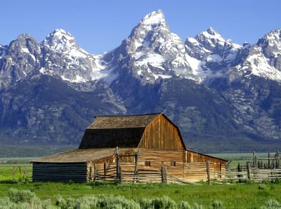
Weathered homestead barns set against the Tetons, including the famous Moulton Barn.
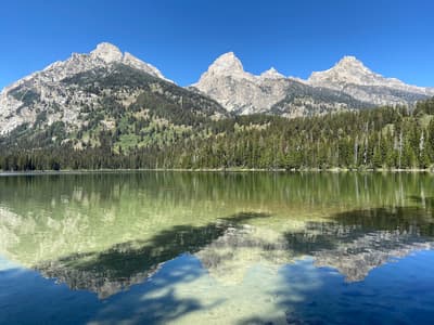
Gentle 3-mile round trip through meadows to a lake at the base of the Grand Teton.
Plan three to four days: one in the geyser basins, one in the canyon and Hayden Valley, one for Mammoth and Lamar.
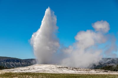
Yellowstone's best-known geyser, erupting roughly every 60–110 minutes.
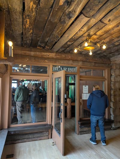
Small bar off the Old Faithful Inn dining room with historic etched-glass panels.
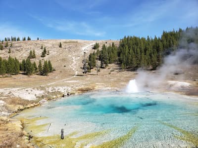
Short climb to a raised platform above Grand Prismatic Spring for the full color rings.
Where Yellowstone National Park → Grand Teton National Park sits in the full itinerary. Highlighted stops are this leg.
Big skies, geothermal wonders & alpine lakes
This is leg 2 of 2, the final leg.
Going the other way? Grand Teton National Park to Yellowstone National Park is the same 71 km in a straight line, heading north. Reverse directions in Google Maps ↗
The biggest gap comes in April, when Grand Teton National Park averages highs 3°C warmer than Yellowstone National Park.
| Measure | Jan | Feb | Mar | Apr | May | Jun | Jul | Aug | Sep | Oct | Nov | Dec |
|---|---|---|---|---|---|---|---|---|---|---|---|---|
| Yellowstone National Park high | -7° | -6° | -2° | 2° | 10° | 16° | 22° | 22° | 16° | 6° | -2° | -7° |
| Grand Teton National Park high | -4° | -3° | 1° | 5° | 12° | 19° | 25° | 24° | 19° | 9° | 1° | -5° |
| Yellowstone National Park rain | 81 | 75 | 77 | 82 | 81 | 70 | 37 | 40 | 52 | 69 | 79 | 91 |
| Grand Teton National Park rain | 83 | 73 | 73 | 75 | 72 | 61 | 30 | 36 | 50 | 65 | 76 | 91 |
Temperatures in °C, rain in mm per month. Long-term monthly averages from NASA POWER satellite climatology — a guide to typical conditions, not a forecast. Month headings link to Grand Teton National Park month guides.
Yellowstone National Park is about 71 km (44 mi) from Grand Teton National Park in a straight line, with Grand Teton National Park to the south. By road, we estimate 86–100 km (53–62 mi), or 1.2–1.4 times the straight line. Check a maps app for the exact route.
An estimated 1 h – 2 h, assuming 86–100 km of road at average speeds of 50–80 km/h with no stops or traffic. It is not a routed time, so check a maps app on the day.
Our Glacier to Yellowstone itinerary includes this leg. Glacier to Yellowstone runs about 8 days across 3 stops, best in Jun – Sep.
Add this leg to a shared itinerary, poll the group on where to stop, split fuel and tickets, and keep everyone's packing list in one place in TripsCircle.