



Washington, Baltimore & Philadelphia
This is leg 1 of 2, the opening leg.
 Get the app
Travel leg · Capital Cities Corridor
Washington, DC and Baltimore sit about 56 km (35 mi) apart in a straight line, with Baltimore to the north-east. It is leg 1 of 2 on our Capital Cities Corridor itinerary, a 6-day trip. Here is how long it takes by train, what to see on the way and where it fits in a real itinerary.

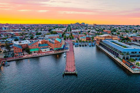
Road distance is estimated as 1.2–1.4× the straight line; drive time assumes average speeds of 50–80 km/h with no stops or traffic. These are rough estimates — check a maps app for the actual route.
We don't have live routing data, so the figures below are labelled estimates built from the straight-line distance. Use them to plan the day, then confirm in a maps app.
Our Capital Cities Corridor itinerary is easy to do on public transport, so a train is the likely way to cover this leg. Timetables and direct connections vary — check the operator before you book.
Driving is an estimated 67–79 km (42–49 mi) and 50 min – 1 h 30 min at typical average speeds, not a routed time.
Most travelers link the three cities by Amtrak or regional rail, which is easy to do without a car. Driving works too, though parking in city centers is a hassle. Once you arrive, each city is best explored on foot, with transit for longer hops.
Picks from our curated guides at both ends.
One full day: Fort McHenry and the Inner Harbor by day, crab cakes, then Fells Point bars at night.

Star-shaped fort whose 1814 defense inspired 'The Star-Spangled Banner'.

Hilltop park with the best view over the Inner Harbor skyline.
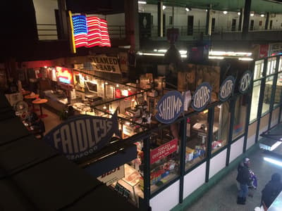
Lexington Market stall since 1886, known for its lump crab cake.

Fells Point saloon dating to 1775, said to be Poe's last drink stop.

Large aquarium with a rooftop rainforest and Atlantic coral reef exhibit.
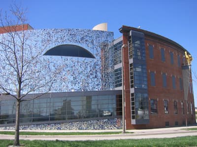
Museum of self-taught artists' work, with mosaic-covered exterior.
Plan two days: one for the Mall's monuments and Smithsonians, one for Capitol Hill and a neighborhood like U Street.
Where Washington → Baltimore sits in the full itinerary. Highlighted stops are this leg.
Washington, Baltimore & Philadelphia
This is leg 1 of 2, the opening leg.
Going the other way? Baltimore to Washington, DC is the same 56 km in a straight line, heading south-west. Reverse directions in Google Maps ↗
Average daytime highs at both ends stay within 1°C of each other all year, so you can pack the same way for both.
| Measure | Jan | Feb | Mar | Apr | May | Jun | Jul | Aug | Sep | Oct | Nov | Dec |
|---|---|---|---|---|---|---|---|---|---|---|---|---|
| Washington high | 4° | 6° | 11° | 18° | 23° | 28° | 31° | 30° | 27° | 20° | 13° | 7° |
| Baltimore high | 4° | 5° | 11° | 18° | 23° | 28° | 31° | 30° | 27° | 20° | 13° | 6° |
| Washington rain | 67 | 70 | 84 | 92 | 109 | 118 | 116 | 109 | 107 | 105 | 80 | 95 |
| Baltimore rain | 70 | 71 | 85 | 94 | 106 | 117 | 114 | 106 | 113 | 109 | 81 | 96 |
Temperatures in °C, rain in mm per month. Long-term monthly averages from NASA POWER satellite climatology — a guide to typical conditions, not a forecast. Month headings link to Baltimore month guides.
Washington, DC is about 56 km (35 mi) from Baltimore in a straight line, with Baltimore to the north-east. By road, we estimate 67–79 km (42–49 mi), or 1.2–1.4 times the straight line. Check a maps app for the exact route.
An estimated 50 min – 1 h 30 min, assuming 67–79 km of road at average speeds of 50–80 km/h with no stops or traffic. It is not a routed time, so check a maps app on the day. Our itinerary leans on rail, so check train times too.
Our Capital Cities Corridor itinerary includes this leg. Capital Cities Corridor runs about 6 days across 3 stops, best in Mar – Jun.
Add this leg to a shared itinerary, poll the group on where to stop, split fuel and tickets, and keep everyone's packing list in one place in TripsCircle.