
Rooftop fireworks, a car-free Strip, red rock
This is leg 1 of 1, the opening leg.
 Get the app
Travel leg · Las Vegas New Year's Eve
The Strip and Red Rock Canyon sit about 23 km (14 mi) apart in a straight line, with Red Rock Canyon to the west. It is leg 1 of 1 on our Las Vegas New Year's Eve itinerary, a 3-day trip. Here is how long it takes by car, what to see on the way and where it fits in a real itinerary.


Road distance is estimated as 1.2–1.4× the straight line; drive time assumes average speeds of 50–80 km/h with no stops or traffic. These are rough estimates — check a maps app for the actual route.
We don't have live routing data, so the figures below are labelled estimates built from the straight-line distance. Use them to plan the day, then confirm in a maps app.
Most travelers on our Las Vegas New Year's Eve itinerary do this leg by car. We estimate 27–32 km (17–20 mi) of road and 20–40 min behind the wheel, so check live traffic before you set off.
Walk: once the Strip closes, cars and rideshares cannot reach resort fronts, and pickups move to back-of-house zones with long waits after midnight. The Las Vegas Monorail along the east side of the Strip typically runs late on NYE, and RTC has offered free bus rides on New Year's Eve in past years. Fremont Street is a 15-minute ride north on the Deuce before the closures. For Jan 1, rent a car or book a tour: Red Rock Canyon is 17 miles west of the Strip on Charleston Boulevard (NV-159), and Spring Mountain Ranch is 5 miles further south.
Open The Strip → Red Rock Canyon directions in Google Maps ↗
Picks from our curated guides at both ends.
Sandstone desert 30 minutes west for a clear-headed Jan 1.

A 2.5-mile round-trip scramble through the Calico Hills sandstone to a seasonal water tank and a view back to the Strip.

Round-the-clock Strip diner since 1972, with oversized breakfasts and a neon lounge built around a fire pit.
BLM visitor center at the start of the Scenic Drive, with desert exhibits and an outdoor tortoise habitat.
A 13-mile one-way loop past the Calico Hills and the Keystone Thrust, with trailheads and pullouts along the way.
Area just outside the Scenic Drive with the Red Spring boardwalk and sandstone walls; no timed entry needed.

Historic ranch under the Wilson Cliffs, with a cabin, blacksmith shop and short trails; Nevada State Parks runs First Day Hikes here.
Two nights on the Boulevard for rooftop fireworks, the Sphere and long dinners.

Grucci's eight-minute midnight show fires from casino rooftops along the Strip, including Caesars Palace, ARIA and the Venetian.
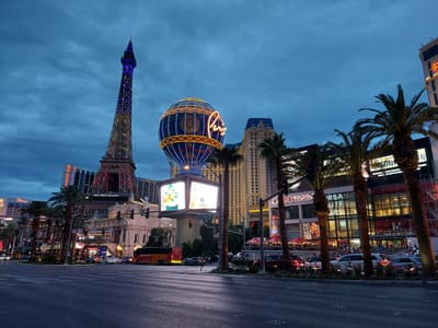
French dining room 11 floors up the half-scale Eiffel Tower at Paris Las Vegas, with windows over the Bellagio fountains.

Downtown's pedestrian mall under a block-long LED canopy, which typically hosts a ticketed NYE street party with live bands.
Where The Strip → Red Rock Canyon sits in the full itinerary. Highlighted stops are this leg.
Rooftop fireworks, a car-free Strip, red rock
This is leg 1 of 1, the opening leg.
Going the other way? Red Rock Canyon to The Strip is the same 23 km in a straight line, heading east. Reverse directions in Google Maps ↗
The Strip is about 23 km (14 mi) from Red Rock Canyon in a straight line, with Red Rock Canyon to the west. By road, we estimate 27–32 km (17–20 mi), or 1.2–1.4 times the straight line. Check a maps app for the exact route.
An estimated 20–40 min, assuming 27–32 km of road at average speeds of 50–80 km/h with no stops or traffic. It is not a routed time, so check a maps app on the day.
Our Las Vegas New Year's Eve itinerary includes this leg. Las Vegas New Year's Eve runs about 3 days across 2 stops, best in Dec 30 – Jan 1.
Add this leg to a shared itinerary, poll the group on where to stop, split fuel and tickets, and keep everyone's packing list in one place in TripsCircle.