


Museums, stone villages and Georgian spa streets
This is leg 2 of 2, the final leg.
 Get the app
Travel leg · London, the Cotswolds & Bath
The Cotswolds and Bath sit about 70 km (44 mi) apart in a straight line, with Bath to the south-west. It is leg 2 of 2 on our London, the Cotswolds & Bath itinerary, an 8-day trip. Here is how long it takes by train, what to see on the way and where it fits in a real itinerary.

Road distance is estimated as 1.2–1.4× the straight line; drive time assumes average speeds of 50–80 km/h with no stops or traffic. These are rough estimates — check a maps app for the actual route.
We don't have live routing data, so the figures below are labelled estimates built from the straight-line distance. Use them to plan the day, then confirm in a maps app.
Our London, the Cotswolds & Bath itinerary is planned around rail, so a train is the likely way to cover this leg. Timetables and direct connections vary — check the operator before you book.
Driving is an estimated 84–98 km (52–61 mi) and 1 h – 2 h at typical average speeds, not a routed time.
Use the Tube and buses in London, then hire a car for the Cotswolds, where trains only reach Moreton-in-Marsh and Kingham. Bath is a 90-minute direct train from London Paddington if you drop the car early.
Picks from our curated guides at both ends.
Compact Georgian city; give it 2 days for the baths, crescents and countryside walks.
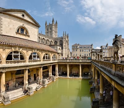
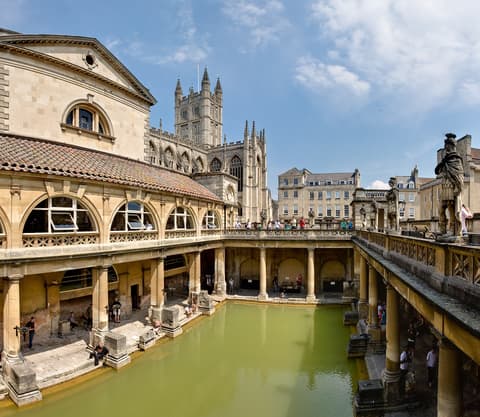
Well-preserved Roman bathing complex fed by hot springs, under the 18th-century Pump Room.
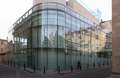
Modern spa with a rooftop pool fed by the city's natural thermal water.
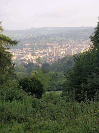
Six-mile National Trust walk through meadows and woods above the city.
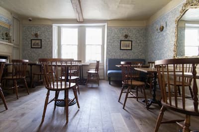
Tea room in one of Bath's oldest houses, serving its namesake light bun.

Community-owned pub on Walcot Street with live music most nights.
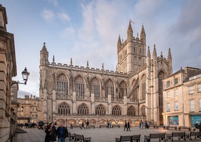
Gothic abbey with fan vaulting and angels climbing ladders on the west front.
Rolling hills and limestone villages; spend 2–3 nights in Stow, Chipping Campden or nearby.
Where The Cotswolds → Bath sits in the full itinerary. Highlighted stops are this leg.
Museums, stone villages and Georgian spa streets
This is leg 2 of 2, the final leg.
Going the other way? Bath to The Cotswolds is the same 70 km in a straight line, heading north-east. Reverse directions in Google Maps ↗
The biggest gap comes in December, when Bath averages highs 2°C warmer than The Cotswolds.
| Measure | Jan | Feb | Mar | Apr | May | Jun | Jul | Aug | Sep | Oct | Nov | Dec |
|---|---|---|---|---|---|---|---|---|---|---|---|---|
| The Cotswolds high | 6° | 6° | 9° | 13° | 16° | 19° | 21° | 21° | 18° | 14° | 9° | 6° |
| Bath high | 7° | 8° | 10° | 13° | 17° | 20° | 22° | 21° | 19° | 15° | 11° | 8° |
| The Cotswolds rain | 71 | 57 | 57 | 51 | 64 | 63 | 70 | 72 | 50 | 81 | 80 | 77 |
| Bath rain | 76 | 60 | 60 | 50 | 60 | 62 | 69 | 72 | 50 | 83 | 86 | 84 |
Temperatures in °C, rain in mm per month. Long-term monthly averages from NASA POWER satellite climatology — a guide to typical conditions, not a forecast. Month headings link to Bath month guides.
The Cotswolds is about 70 km (44 mi) from Bath in a straight line, with Bath to the south-west. By road, we estimate 84–98 km (52–61 mi), or 1.2–1.4 times the straight line. Check a maps app for the exact route.
An estimated 1 h – 2 h, assuming 84–98 km of road at average speeds of 50–80 km/h with no stops or traffic. It is not a routed time, so check a maps app on the day. Our itinerary leans on rail, so check train times too.
Our London, the Cotswolds & Bath itinerary includes this leg. London, the Cotswolds & Bath runs about 8 days across 3 stops, best in May – Sep.
Add this leg to a shared itinerary, poll the group on where to stop, split fuel and tickets, and keep everyone's packing list in one place in TripsCircle.