
Nights of Lights and a warm Florida coast
This is leg 1 of 1, the opening leg.
 Get the app
Travel leg · St. Augustine & Amelia Island
St. Augustine and Amelia Island sit about 87 km (54 mi) apart in a straight line, with Amelia Island to the north. It is leg 1 of 1 on our St. Augustine & Amelia Island itinerary, a 5-day trip. Here is how long it takes by car, what to see on the way and where it fits in a real itinerary.
Road distance is estimated as 1.2–1.4× the straight line; drive time assumes average speeds of 50–80 km/h with no stops or traffic. These are rough estimates — check a maps app for the actual route.
We don't have live routing data, so the figures below are labelled estimates built from the straight-line distance. Use them to plan the day, then confirm in a maps app.
Most travelers on our St. Augustine & Amelia Island itinerary do this leg by car. We estimate 105–122 km (65–76 mi) of road and 1 h 15 min – 2 h 30 min behind the wheel, so check live traffic before you set off.
Fly into Jacksonville (JAX), about 50 minutes from St. Augustine and 25 minutes from Fernandina Beach. In St. Augustine, park once (the Historic Downtown Parking Facility on Castillo Drive is closest) and walk; the trolley and tram tours run dedicated Nights of Lights routes. St. Augustine to Fernandina Beach is about 1 hr 30 min on I-95, or take the slower A1A coast road with the St. Johns River Ferry at Mayport.
Open St. Augustine → Amelia Island directions in Google Maps ↗
Picks from our curated guides at both ends, plus 6 places near the straight-line path.
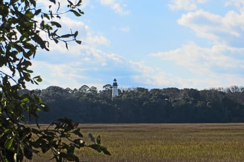
Victorian Fernandina Beach, a Civil War fort and empty winter beaches; 2 nights.

Main street of Fernandina Beach's 50-block historic district, with Victorian brick storefronts running down to the harbor.

Florida's oldest continuously operating bar, open since 1903 behind a carved mahogany bar on Centre Street.

Brick 19th-century fort at the island's north tip, with costumed garrison programs, beach and maritime-forest trails.

Fernandina Beach's main public beach on the Atlantic, with a long boardwalk and wide, firm sand.
Casual local seafood counter a block off Centre Street, known for local wild-caught shrimp and fish tacos.
Oceanfront resort on the island's south end, with a long beachfront, spa and golf course.
These places from our other itineraries sit within about 13 km of the straight line between St. Augustine and Amelia Island. The road may not pass them directly, so check how far off your route they are.
The city's New Year's Day plunge into the Atlantic, held for over 30 years; more than 1,000 people went in for 2026.

Long concrete fishing pier off the main beach, rebuilt after hurricane damage, with a small fee to walk out.
Jacksonville-born diner, first opened in San Marco in 1992, known for fried chicken and waffles.

Open-air beach bar at the end of Lemon Street in Neptune Beach, known for its frozen lemon drink.
City park north of Atlantic Beach with about a mile and a half of beach, a freshwater lake and wooded trails.

Undeveloped barrier island with miles of beach, dunes and a trail through maritime forest.
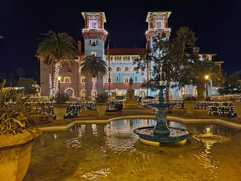
America's oldest city under millions of white lights; 3 nights for the forts, Flagler hotels and plaza.

The town's central plaza, laid out in 1573, is the heart of Nights of Lights, with the oaks and gazebo strung in white lights.

Pedestrian street through the colonial quarter, lined with shops, cafes and reconstructed Spanish houses.

Black-and-white spiral lighthouse from 1874 on Anastasia Island; 219 steps lead to views over the bay and old town.
Where St. Augustine → Amelia Island sits in the full itinerary. Highlighted stops are this leg.
Nights of Lights and a warm Florida coast
This is leg 1 of 1, the opening leg.
Going the other way? Amelia Island to St. Augustine is the same 87 km in a straight line, heading south. Reverse directions in Google Maps ↗
The biggest gap comes in February, when Amelia Island averages highs 2°C cooler than St. Augustine. Over a year, St. Augustine gets about 190 mm more rain.
| Measure | Jan | Feb | Mar | Apr | May | Jun | Jul | Aug | Sep | Oct | Nov | Dec |
|---|---|---|---|---|---|---|---|---|---|---|---|---|
| St. Augustine high | 18° | 19° | 21° | 24° | 27° | 29° | 30° | 30° | 29° | 26° | 22° | 20° |
| Amelia Island high | 17° | 17° | 20° | 23° | 26° | 28° | 29° | 29° | 28° | 25° | 21° | 18° |
| St. Augustine rain | 79 | 81 | 85 | 68 | 107 | 189 | 161 | 191 | 168 | 96 | 61 | 84 |
| Amelia Island rain | 64 | 76 | 71 | 60 | 90 | 169 | 133 | 170 | 137 | 89 | 52 | 73 |
Temperatures in °C, rain in mm per month. Long-term monthly averages from NASA POWER satellite climatology — a guide to typical conditions, not a forecast. Month headings link to Amelia Island month guides.
St. Augustine is about 87 km (54 mi) from Amelia Island in a straight line, with Amelia Island to the north. By road, we estimate 105–122 km (65–76 mi), or 1.2–1.4 times the straight line. Check a maps app for the exact route.
An estimated 1 h 15 min – 2 h 30 min, assuming 105–122 km of road at average speeds of 50–80 km/h with no stops or traffic. It is not a routed time, so check a maps app on the day.
Near the straight-line path we have 6 places from our curated guides, including Jax Beach Polar Plunge (Jacksonville Beach), Jacksonville Beach Pier (Jacksonville Beach), Metro Diner (Jacksonville Beach), Lemon Bar (Jacksonville Beach). The road may not pass them directly, so check the detour.
Our St. Augustine & Amelia Island itinerary includes this leg. St. Augustine & Amelia Island runs about 5 days across 2 stops, best in Late Nov – Jan.
Add this leg to a shared itinerary, poll the group on where to stop, split fuel and tickets, and keep everyone's packing list in one place in TripsCircle.