
Danish Julefest and a Spanish mission Christmas
This is leg 1 of 1, the opening leg.
 Get the app
Travel leg · Solvang & Santa Barbara
Solvang and Santa Barbara sit about 45 km (28 mi) apart in a straight line, with Santa Barbara to the south-east. It is leg 1 of 1 on our Solvang & Santa Barbara itinerary, a 4-day trip. Here is how long it takes by car, what to see on the way and where it fits in a real itinerary.

Road distance is estimated as 1.2–1.4× the straight line; drive time assumes average speeds of 50–80 km/h with no stops or traffic. These are rough estimates — check a maps app for the actual route.
We don't have live routing data, so the figures below are labelled estimates built from the straight-line distance. Use them to plan the day, then confirm in a maps app.
Most travelers on our Solvang & Santa Barbara itinerary do this leg by car. We estimate 54–63 km (33–39 mi) of road and 40 min – 1 h 15 min behind the wheel, so check live traffic before you set off.
Fly into Santa Barbara Airport (SBA), or Los Angeles (LAX), about 2 hours south. A car is needed: Solvang is 45 minutes from Santa Barbara over Highway 154 and San Marcos Pass, and Los Olivos is 10 minutes north of Solvang. Downtown Solvang is easily walkable, as are Santa Barbara's State Street, the Funk Zone and the waterfront.
Picks from our curated guides at both ends.
Spanish Revival city between the mountains and the sea; 2 nights for the mission, harbor and beaches.

1786 mission called the Queen of the Missions, with a museum and rose garden.

Tiny taqueria praised by Julia Child for its handmade tortillas.

Single-vineyard Santa Barbara County wines in a lounge at The Mill, with a patio shared with Third Window Brewery.

Wide sandy beach with volleyball courts and a palm-lined bike path.
Boats strung with Christmas lights circle the harbor after dark, followed by fireworks over the water.
Hillside hotel on the Riviera above the mission, with garden bungalows and a terrace looking to the sea.
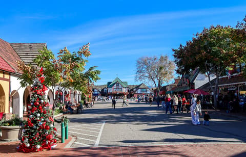
Danish-founded village decorated for Julefest; 2 nights for bakeries, the mission and wine country.

The village's month-long Christmas festival, with lights on the half-timbered shops, a parade and a Nisse hunt.

Small park at the center of the village with a bust of Hans Christian Andersen on a fieldstone base.

Seasonal waterfall over a mossy limestone face, reached by a short shaded trail in a county park south of town.
Where Solvang → Santa Barbara sits in the full itinerary. Highlighted stops are this leg.
Danish Julefest and a Spanish mission Christmas
This is leg 1 of 1, the opening leg.
Going the other way? Santa Barbara to Solvang is the same 45 km in a straight line, heading north-west. Reverse directions in Google Maps ↗
Average daytime highs at both ends stay within 1°C of each other all year, so you can pack the same way for both.
| Measure | Jan | Feb | Mar | Apr | May | Jun | Jul | Aug | Sep | Oct | Nov | Dec |
|---|---|---|---|---|---|---|---|---|---|---|---|---|
| Solvang high | 17° | 17° | 18° | 19° | 22° | 25° | 27° | 27° | 27° | 24° | 20° | 17° |
| Santa Barbara high | 18° | 17° | 19° | 20° | 23° | 26° | 28° | 28° | 27° | 25° | 21° | 17° |
| Solvang rain | 90 | 78 | 63 | 27 | 11 | 3 | 2 | 1 | 3 | 22 | 32 | 72 |
| Santa Barbara rain | 90 | 78 | 63 | 27 | 11 | 3 | 2 | 1 | 3 | 22 | 32 | 72 |
Temperatures in °C, rain in mm per month. Long-term monthly averages from NASA POWER satellite climatology — a guide to typical conditions, not a forecast. Month headings link to Santa Barbara month guides.
Solvang is about 45 km (28 mi) from Santa Barbara in a straight line, with Santa Barbara to the south-east. By road, we estimate 54–63 km (33–39 mi), or 1.2–1.4 times the straight line. Check a maps app for the exact route.
An estimated 40 min – 1 h 15 min, assuming 54–63 km of road at average speeds of 50–80 km/h with no stops or traffic. It is not a routed time, so check a maps app on the day.
Our Solvang & Santa Barbara itinerary includes this leg. Solvang & Santa Barbara runs about 4 days across 2 stops, best in Early Dec – early Jan.
Add this leg to a shared itinerary, poll the group on where to stop, split fuel and tickets, and keep everyone's packing list in one place in TripsCircle.