
Maasai Mara, Serengeti and Ngorongoro Crater
This is leg 3 of 3, the final leg.
 Get the app
Travel leg · Kenya & Tanzania Safari
Serengeti and Ngorongoro sit about 122 km (76 mi) apart in a straight line, with Ngorongoro to the south-east. It is leg 3 of 3 on our Kenya & Tanzania Safari itinerary, an 11-day trip. Here is how long it takes by car, what to see on the way and where it fits in a real itinerary.

Road distance is estimated as 1.2–1.4× the straight line; drive time assumes average speeds of 65–95 km/h with no stops or traffic. These are rough estimates — check a maps app for the actual route.
We don't have live routing data, so the figures below are labelled estimates built from the straight-line distance. Use them to plan the day, then confirm in a maps app.
Most travelers on our Kenya & Tanzania Safari itinerary do this leg by car. We estimate 146–170 km (91–106 mi) of road and 1 h 30 min – 2 h 30 min behind the wheel, so check live traffic before you set off.
Light aircraft link Nairobi's Wilson Airport with Mara airstrips and Arusha with Serengeti strips; there are no tourist crossings at the Mara–Serengeti border, so you fly between countries. Game drives are with your camp's guide or a licensed safari operator.
Picks from our curated guides at both ends.
The world's largest intact volcanic caldera, with dense wildlife on its floor. Stay 2 nights.

Caldera about 20 km across, home to lions, buffalo, flamingos and one of the best chances to see black rhino.

Museum at the gorge where the Leakeys found early human fossils, with a talk over the site.

Small Nomad Tanzania camp on the crater's western rim, serving set meals with views across the crater floor.

Stone lodge built into the crater rim, with a bar and terrace looking over the caldera.

Shallow soda lake on the crater floor where flamingos feed and hippos wallow.

Yellow-barked acacia forest on the crater floor, a good spot for elephants and bushbuck.
Tanzania's vast plains, with predators around Seronera and herds that move with the rains. Stay 3 to 4 nights.

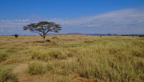
Tanzania's flagship park, 14,750 sq km of plains and kopjes supporting huge herds and predators.

Seronera information center with an elevated walkway and displays on the ecosystem and migration.

Lodge in the central Serengeti with an infinity pool above an elephant waterhole and a Discovery Centre.
Where Serengeti → Ngorongoro sits in the full itinerary. Highlighted stops are this leg.
Maasai Mara, Serengeti and Ngorongoro Crater
This is leg 3 of 3, the final leg.
Going the other way? Ngorongoro to Serengeti is the same 122 km in a straight line, heading north-west. Reverse directions in Google Maps ↗
The biggest gap comes in July, when Ngorongoro averages highs 6°C cooler than Serengeti. Over a year, Ngorongoro gets about 180 mm more rain.
| Measure | Jan | Feb | Mar | Apr | May | Jun | Jul | Aug | Sep | Oct | Nov | Dec |
|---|---|---|---|---|---|---|---|---|---|---|---|---|
| Serengeti high | 27° | 28° | 28° | 26° | 26° | 27° | 28° | 29° | 30° | 30° | 28° | 27° |
| Ngorongoro high | 24° | 25° | 24° | 23° | 22° | 22° | 22° | 24° | 26° | 26° | 25° | 24° |
| Serengeti rain | 119 | 79 | 141 | 142 | 66 | 17 | 9 | 20 | 26 | 60 | 140 | 134 |
| Ngorongoro rain | 143 | 101 | 153 | 190 | 95 | 18 | 5 | 13 | 19 | 79 | 167 | 151 |
Temperatures in °C, rain in mm per month. Long-term monthly averages from NASA POWER satellite climatology — a guide to typical conditions, not a forecast. Month headings link to Ngorongoro month guides.
Serengeti is about 122 km (76 mi) from Ngorongoro in a straight line, with Ngorongoro to the south-east. By road, we estimate 146–170 km (91–106 mi), or 1.2–1.4 times the straight line. Check a maps app for the exact route.
An estimated 1 h 30 min – 2 h 30 min, assuming 146–170 km of road at average speeds of 65–95 km/h with no stops or traffic. It is not a routed time, so check a maps app on the day.
Our Kenya & Tanzania Safari itinerary includes this leg. Kenya & Tanzania Safari runs about 11 days across 4 stops, best in Jun – Oct.
Add this leg to a shared itinerary, poll the group on where to stop, split fuel and tickets, and keep everyone's packing list in one place in TripsCircle.