


Rice terraces, temples & clifftop beaches
This is leg 2 of 2, the final leg.
 Get the app
Travel leg · Bali Island Loop
Nusa Penida and Uluwatu sit about 52 km (32 mi) apart in a straight line, with Uluwatu to the west. It is leg 2 of 2 on our Bali Island Loop itinerary, a 9-day trip. This one most likely involves a water crossing, so check ferry schedules early.


This leg most likely crosses water, so we don’t estimate road distance or drive time. Check ferry or flight schedules for the actual crossing.
We don't have live routing data, so the figures below are labelled estimates built from the straight-line distance. Use them to plan the day, then confirm in a maps app.
Nusa Penida most likely needs a water crossing from here, so start with ferry schedules. Sailings can vary by season.
Private drivers and ride-hailing are the usual way to move between Ubud and the south, and traffic can be slow. Fast boats run to Nusa Penida from the east coast. On the island, scooters are common, but a driver is easier for groups.
Picks from our curated guides at both ends.
Give Uluwatu two days: beaches and surf breaks by day, the cliff temple and Kecak at dusk, and Jimbaran seafood one night.
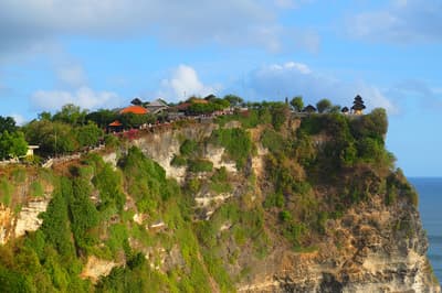
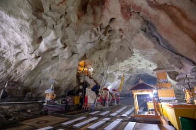
11th-century sea temple on a 70-meter cliff with resident monkeys.
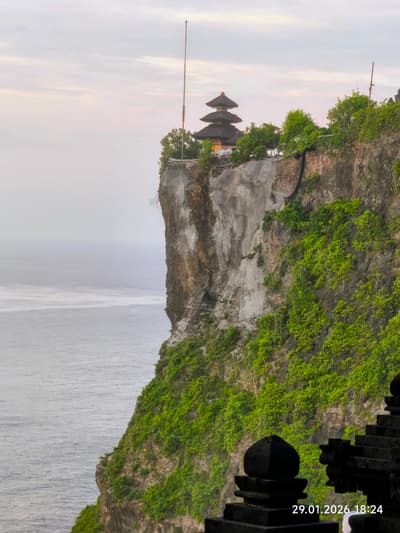
Ramayana dance performed by chanting chorus at the cliff amphitheater at sunset.
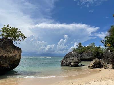
Small cove through a rock crevice with a famous reef break.

Clifftop bar above Uluwatu's surf breaks.

Spanish cliff restaurant with tapas and paella over the ocean.

Cliffside beach with warungs and surf breaks.
Stay at least one night: the west coast viewpoints take a full day, with a snorkel trip the next morning.
Where Nusa Penida → Uluwatu sits in the full itinerary. Highlighted stops are this leg.
Rice terraces, temples & clifftop beaches
This is leg 2 of 2, the final leg.
Going the other way? Uluwatu to Nusa Penida is the same 52 km in a straight line, heading east. Reverse directions in Google Maps ↗
The biggest gap comes in February, when Uluwatu averages highs 2°C warmer than Nusa Penida. Over a year, Nusa Penida gets about 170 mm more rain.
| Measure | Jan | Feb | Mar | Apr | May | Jun | Jul | Aug | Sep | Oct | Nov | Dec |
|---|---|---|---|---|---|---|---|---|---|---|---|---|
| Nusa Penida high | 26° | 26° | 26° | 26° | 26° | 25° | 25° | 25° | 26° | 27° | 27° | 26° |
| Uluwatu high | 28° | 28° | 28° | 28° | 28° | 27° | 26° | 26° | 26° | 27° | 28° | 28° |
| Nusa Penida rain | 318 | 251 | 206 | 123 | 82 | 46 | 33 | 16 | 42 | 62 | 159 | 296 |
| Uluwatu rain | 296 | 230 | 190 | 120 | 74 | 47 | 36 | 20 | 31 | 53 | 118 | 254 |
Temperatures in °C, rain in mm per month. Long-term monthly averages from NASA POWER satellite climatology — a guide to typical conditions, not a forecast. Month headings link to Uluwatu month guides.
Nusa Penida is about 52 km (32 mi) from Uluwatu in a straight line, with Uluwatu to the west. The trip most likely involves a water crossing, so the distance you actually travel depends on the ferry or flight route.
We don't estimate a drive time for this one: it most likely crosses water, so check ferry schedules before you plan the day.
Our Bali Island Loop itinerary includes this leg. Bali Island Loop runs about 9 days across 3 stops, best in Apr – Oct.
Add this leg to a shared itinerary, poll the group on where to stop, split fuel and tickets, and keep everyone's packing list in one place in TripsCircle.