


Castles, lochs & the West Highland Line
This is leg 2 of 2, the final leg.
 Get the app
Travel leg · Scotland’s Highland Rail Line
Fort William and Inverness sit about 90 km (56 mi) apart in a straight line, with Inverness to the north-east. It is leg 2 of 2 on our Scotland’s Highland Rail Line itinerary, a 7-day trip. Here is how long it takes by train, what to see on the way and where it fits in a real itinerary.
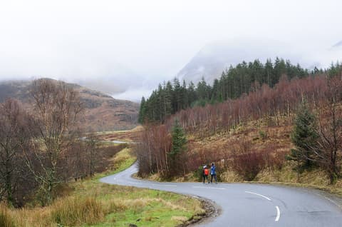
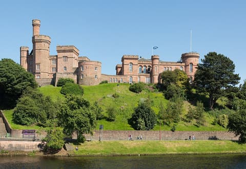
Road distance is estimated as 1.2–1.4× the straight line; drive time assumes average speeds of 50–80 km/h with no stops or traffic. These are rough estimates — check a maps app for the actual route.
We don't have live routing data, so the figures below are labelled estimates built from the straight-line distance. Use them to plan the day, then confirm in a maps app.
Our Scotland’s Highland Rail Line itinerary is planned around rail, so a train is the likely way to cover this leg. Timetables and direct connections vary — check the operator before you book.
Driving is an estimated 108–127 km (67–79 mi) and 1 h 15 min – 2 h 30 min at typical average speeds, not a routed time.
Rail suits the Edinburgh to Fort William to Inverness arc, with scenic lines through the western Highlands. Local buses, tours or short taxi rides help for places like Glenfinnan, Loch Ness and Culloden, though a rental car adds flexibility between stations.
Picks from our curated guides at both ends.
Spend 2 days: one on Loch Ness and Urquhart Castle, one at Culloden, Clava Cairns and in town.

Riverside walk over footbridges to wooded islands in the River Ness.

1870s covered arcade with independent shops and a food hall.

Loch Ness boat trips from the Caledonian Canal, some stopping at Urquhart Castle.

Ruined castle on a headland over Loch Ness.

Riverside restaurant in a former church with Scottish produce.

Pub with live Scottish trad music sessions most nights.
Stay 2 nights: one day on the Jacobite steam train to Glenfinnan, one on Ben Nevis or in Glen Nevis.
Where Fort William → Inverness sits in the full itinerary. Highlighted stops are this leg.
Castles, lochs & the West Highland Line
This is leg 2 of 2, the final leg.
Going the other way? Inverness to Fort William is the same 90 km in a straight line, heading south-west. Reverse directions in Google Maps ↗
Average daytime highs at both ends stay within 1°C of each other all year, so you can pack the same way for both. Over a year, Fort William gets about 890 mm more rain.
| Measure | Jan | Feb | Mar | Apr | May | Jun | Jul | Aug | Sep | Oct | Nov | Dec |
|---|---|---|---|---|---|---|---|---|---|---|---|---|
| Fort William high | 6° | 6° | 7° | 11° | 14° | 16° | 18° | 17° | 15° | 12° | 8° | 6° |
| Inverness high | 5° | 6° | 8° | 11° | 14° | 17° | 18° | 18° | 15° | 12° | 8° | 6° |
| Fort William rain | 191 | 140 | 134 | 100 | 125 | 131 | 148 | 166 | 152 | 177 | 167 | 184 |
| Inverness rain | 72 | 61 | 61 | 56 | 73 | 84 | 95 | 102 | 75 | 95 | 75 | 72 |
Temperatures in °C, rain in mm per month. Long-term monthly averages from NASA POWER satellite climatology — a guide to typical conditions, not a forecast. Month headings link to Inverness month guides.
Fort William is about 90 km (56 mi) from Inverness in a straight line, with Inverness to the north-east. By road, we estimate 108–127 km (67–79 mi), or 1.2–1.4 times the straight line. Check a maps app for the exact route.
An estimated 1 h 15 min – 2 h 30 min, assuming 108–127 km of road at average speeds of 50–80 km/h with no stops or traffic. It is not a routed time, so check a maps app on the day. Our itinerary leans on rail, so check train times too.
Our Scotland’s Highland Rail Line itinerary includes this leg. Scotland’s Highland Rail Line runs about 7 days across 3 stops, best in May – Sep.
Add this leg to a shared itinerary, poll the group on where to stop, split fuel and tickets, and keep everyone's packing list in one place in TripsCircle.