
Mountains, trails & alpine lakes
This is leg 1 of 2, the opening leg.
 Get the app
Travel leg · Colorado Rockies
Denver and Rocky Mountain NP sit about 89 km (56 mi) apart in a straight line, with Rocky Mountain NP to the north-west. It is leg 1 of 2 on our Colorado Rockies itinerary, a 6-day trip. Here is how long it takes by car, what to see on the way and where it fits in a real itinerary.

Road distance is estimated as 1.2–1.4× the straight line; drive time assumes average speeds of 50–80 km/h with no stops or traffic. These are rough estimates — check a maps app for the actual route.
We don't have live routing data, so the figures below are labelled estimates built from the straight-line distance. Use them to plan the day, then confirm in a maps app.
Most travelers on our Colorado Rockies itinerary do this leg by car. We estimate 107–125 km (67–78 mi) of road and 1 h 15 min – 2 h 30 min behind the wheel, so check live traffic before you set off.
Most travelers fly into Denver and rent a car, since the mountain legs involve long, scenic drives with few alternatives. Mountain roads can be slow, particularly on weekends, so leave a buffer. Check road and park conditions before each leg.
Picks from our curated guides at both ends.
Plan two days: one for the Bear Lake corridor hikes, one for the Trail Ridge Road drive; stay in Estes Park.

Flat half-mile loop around a subalpine lake under Hallett Peak, and the trailhead for the park's classic hikes.

Easy 1.6-mile round-trip hike to a 30-foot cascade on Glacier Creek.

Highest visitor center in the National Park System, with tundra trails and a cafe.
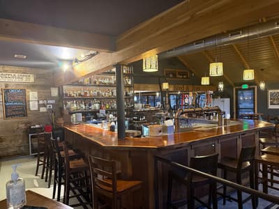
Estes Park restaurant near the Beaver Meadows entrance, with seasonal mountain cooking and a patio.
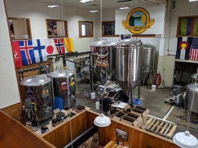
Estes Park's longtime brewpub, open since 1993, for post-hike pints and pub food.
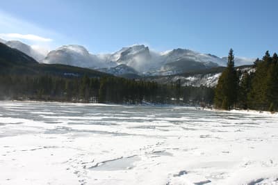
Easy, flat loop with mirror reflections of the Continental Divide.
Give Denver one full day to acclimate to altitude before heading into the mountains; base yourself downtown or in RiNo.
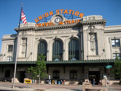
Restored 1914 rail hall with bars, shops and a lounge-like Great Hall at the heart of LoDo.
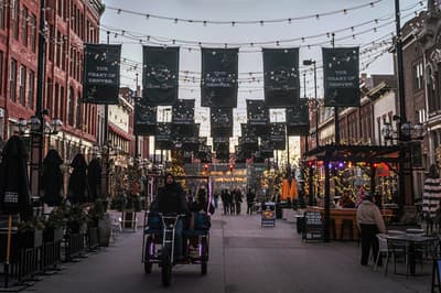
Denver's oldest block, lined with Victorian buildings, string lights, shops and restaurants.
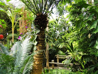
24 acres of themed gardens including a Japanese garden and a high-plains alpine collection.
Where Denver → Rocky Mountain NP sits in the full itinerary. Highlighted stops are this leg.
Mountains, trails & alpine lakes
This is leg 1 of 2, the opening leg.
Going the other way? Rocky Mountain NP to Denver is the same 89 km in a straight line, heading south-east. Reverse directions in Google Maps ↗
The biggest gap comes in March, when Rocky Mountain NP averages highs 12°C cooler than Denver.
| Measure | Jan | Feb | Mar | Apr | May | Jun | Jul | Aug | Sep | Oct | Nov | Dec |
|---|---|---|---|---|---|---|---|---|---|---|---|---|
| Denver high | 7° | 8° | 14° | 18° | 24° | 31° | 33° | 32° | 28° | 20° | 13° | 7° |
| Rocky Mountain NP high | -4° | -4° | 1° | 6° | 12° | 20° | 24° | 22° | 17° | 9° | 2° | -4° |
| Denver rain | 17 | 21 | 34 | 51 | 58 | 42 | 62 | 52 | 36 | 30 | 18 | 19 |
| Rocky Mountain NP rain | 34 | 39 | 47 | 65 | 69 | 44 | 54 | 44 | 42 | 43 | 35 | 37 |
Temperatures in °C, rain in mm per month. Long-term monthly averages from NASA POWER satellite climatology — a guide to typical conditions, not a forecast. Month headings link to Rocky Mountain NP month guides.
Denver is about 89 km (56 mi) from Rocky Mountain NP in a straight line, with Rocky Mountain NP to the north-west. By road, we estimate 107–125 km (67–78 mi), or 1.2–1.4 times the straight line. Check a maps app for the exact route.
An estimated 1 h 15 min – 2 h 30 min, assuming 107–125 km of road at average speeds of 50–80 km/h with no stops or traffic. It is not a routed time, so check a maps app on the day.
Our Colorado Rockies itinerary includes this leg. Colorado Rockies runs about 6 days across 3 stops, best in Jun – Sep.
Add this leg to a shared itinerary, poll the group on where to stop, split fuel and tickets, and keep everyone's packing list in one place in TripsCircle.