
Canadian Rockies icefields
This is leg 1 of 2, the opening leg.
 Get the app
Travel leg · Banff & Jasper Loop
Banff and Lake Louise sit about 50 km (31 mi) apart in a straight line, with Lake Louise to the north-west. It is leg 1 of 2 on our Banff & Jasper Loop itinerary, a 7-day trip. Here is how long it takes by car, what to see on the way and where it fits in a real itinerary.

Road distance is estimated as 1.2–1.4× the straight line; drive time assumes average speeds of 50–80 km/h with no stops or traffic. These are rough estimates — check a maps app for the actual route.
We don't have live routing data, so the figures below are labelled estimates built from the straight-line distance. Use them to plan the day, then confirm in a maps app.
Most travelers on our Banff & Jasper Loop itinerary do this leg by car. We estimate 60–70 km (38–44 mi) of road and 45 min – 1 h 30 min behind the wheel, so check live traffic before you set off.
Most groups drive a rental car, which makes the Icefields Parkway easy to take at your own pace. Some popular spots, such as Moraine Lake, use shuttles in season. Check park and road conditions before each day and allow extra time for wildlife and scenic stops.
Picks from our curated guides at both ends.
Give it a full day: early Lake Louise, a teahouse hike, and Moraine Lake by Parks Canada shuttle.

Flat path along the turquoise lake toward Victoria Glacier.

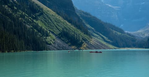
Rent a red canoe for a paddle on Lake Louise.

Historic 1905 teahouse at a hanging lake, reached by a 3.5 km climb.

Long-running bakery in Samson Mall; cheap sandwiches and pastries for the trail.

Longer hike past the lake to a teahouse below Victoria Glacier.
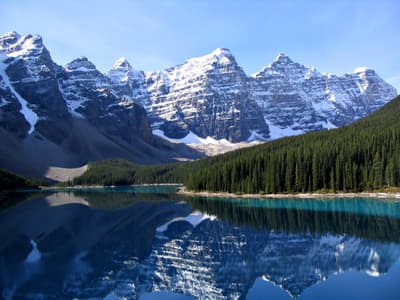
Glacier-fed lake below the Valley of the Ten Peaks; reached only by shuttle or tour.
Base here 2–3 days: gondola and hot springs in town, Lake Minnewanka and Johnston Canyon nearby, and easy dinners on Banff Avenue.
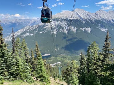
Gondola up Sulphur Mountain to a summit boardwalk with views over six ranges.

Birthplace of Canada's national parks, with a thermal cave and marsh boardwalk.
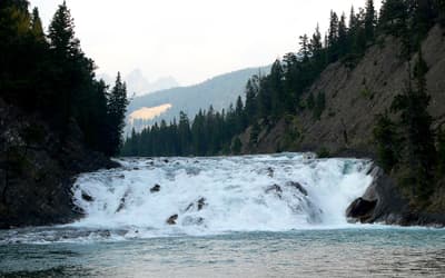
Wide falls on the Bow River below the Fairmont Banff Springs, an easy walk from town.
Where Banff → Lake Louise sits in the full itinerary. Highlighted stops are this leg.
Canadian Rockies icefields
This is leg 1 of 2, the opening leg.
Going the other way? Lake Louise to Banff is the same 50 km in a straight line, heading south-east. Reverse directions in Google Maps ↗
The biggest gap comes in May, when Lake Louise averages highs 4°C cooler than Banff. Over a year, Lake Louise gets about 180 mm more rain.
| Measure | Jan | Feb | Mar | Apr | May | Jun | Jul | Aug | Sep | Oct | Nov | Dec |
|---|---|---|---|---|---|---|---|---|---|---|---|---|
| Banff high | -5° | -4° | 0° | 4° | 12° | 17° | 21° | 20° | 15° | 7° | -1° | -6° |
| Lake Louise high | -5° | -5° | -2° | 2° | 9° | 15° | 19° | 18° | 13° | 5° | -3° | -7° |
| Banff rain | 45 | 42 | 61 | 62 | 83 | 121 | 70 | 63 | 69 | 61 | 60 | 48 |
| Lake Louise rain | 69 | 56 | 89 | 70 | 82 | 117 | 86 | 70 | 80 | 86 | 90 | 66 |
Temperatures in °C, rain in mm per month. Long-term monthly averages from NASA POWER satellite climatology — a guide to typical conditions, not a forecast. Month headings link to Lake Louise month guides.
Banff is about 50 km (31 mi) from Lake Louise in a straight line, with Lake Louise to the north-west. By road, we estimate 60–70 km (38–44 mi), or 1.2–1.4 times the straight line. Check a maps app for the exact route.
An estimated 45 min – 1 h 30 min, assuming 60–70 km of road at average speeds of 50–80 km/h with no stops or traffic. It is not a routed time, so check a maps app on the day.
Our Banff & Jasper Loop itinerary includes this leg. Banff & Jasper Loop runs about 7 days across 3 stops, best in Jun – Sep.
Add this leg to a shared itinerary, poll the group on where to stop, split fuel and tickets, and keep everyone's packing list in one place in TripsCircle.